
Imperial Russia
Imperial Russia: A Five-Day Historical Route
Step into the grand sweep of imperial history on the most ambitious route in this series — Imperial Russia — a five-day, 450 km journey across 61 remarkable sites that together tell the story of Pridnestrovie’s deep and enduring connection to the Russian Empire. From mighty fortresses and military monuments to ancient churches, historic estates and the traces of legendary commanders, this route is a must for every lover of history who feels the pull of a great imperial past.
The history of Pridnestrovie is inextricably linked with the Russian Empire — in its architecture, its churches, its place names and its people. This route traces that connection across the full length of the region, from Bender in the south to Kamenka in the north, uncovering stories that span centuries of empire, war, faith and culture.
Day 1 — Bender and Kitskany: The Empire’s Southern Stronghold
The journey begins at the Bendery Military Historical Memorial Complex (Yermakova Str., Bender) — a sweeping ensemble of monuments and memorials erected on the site of an ancient military cemetery where soldiers of the Russian Imperial Army from the wars of the 18th through 20th centuries were laid to rest. A powerful and historically layered starting point for an imperial journey.
Just 49 meters away, the Monument to Field Marshal Prince G.A. Potemkin-Tavrichesky (Yermakova Str.) honors one of the most influential figures of Catherine the Great’s empire — the statesman, military commander and visionary who transformed the entire southern frontier and whose legacy is felt throughout this region to this day.
After 1.2 km, the Memorial Sign to R.N. Gerbel (Petra Panina Str.) commemorates the Russian Imperial Army general who played a decisive role in the siege and storming of the Bender Fortress in 1770 — a key moment in the empire’s expansion southward.
Just 230 meters further, the Monument to the Victims of the First World War (Petra Panina Str.) honors the soldiers who fell on these battlefields in 1914–1918 — the last great conflict of the imperial era, whose echoes still resonate in the stones of this city.
After 1.3 km, the Monument to the 55th Podolsk Infantry Regiment (Petra Panina Str.) pays tribute to one of the most distinguished regiments of the Russian Imperial Army, whose service in this region left an indelible mark on its military history.
Just 860 meters away, the Bust of General-in-Chief P.I. Panin (Petra Panina Str.) honors the commander whose victory over the Ottoman forces secured Bender for the Russian Empire — a figure so central to the city’s history that its main street bears his name.
After 3.5 km, the magnificent Bendery Fortress (2/3 Petra Panina Str.) stands as the most dramatic and iconic imperial monument in all of southern Pridnestrovie. Originally built by the Ottomans, it became a symbol of Russian imperial power after its capture — a mighty stronghold whose walls have witnessed centuries of history.
Just 3.2 km away, the Church of the Faithful Saint Prince Alexander Nevsky (2 Petra Panina Str.) — erected in 1833 and the only active military temple in Pridnestrovie — embodies the inseparable bond between Orthodox faith and Russian imperial military tradition.
After 1.8 km, the graceful Transfiguration Cathedral (31 Sovetskaya Str.) rises as one of Bender’s most beloved landmarks — a spiritual centerpiece of the city that has presided over its imperial and post-imperial history alike.
Just 640 meters away, the Bender Local History Museum (40-42 Sovetskaya Str.) provides an essential depth of historical context for everything seen so far — its collections spanning the full arc of Bender’s imperial heritage.
After 1.1 km, the Monument to A.S. Pushkin (Pushkina Str., Bender) honors Russia’s greatest poet, who spent time in exile in this region and whose connection to these southern lands adds a literary and cultural dimension to the imperial story.
Just 86 meters away, the Agroprombank Branch — Former Residential Building of Notary Matveyev (75 Pushkin Str.) is a beautifully preserved piece of imperial-era civic architecture that speaks of the prosperous professional class that flourished under Russian imperial administration.
After 1.4 km, the Convent of the Holy Apostles Peter and Paul (44 Komsomolskaya Str., Bender) offers a moment of spiritual reflection — a convent whose foundation and architecture are deeply rooted in the Orthodox tradition that the Russian Empire carried southward as it expanded.
Just 1 km further, the Medical College in Bender (23 Gagarin Str.) — once the Jewish hospital — represents the civic and philanthropic institutions that characterized imperial-era urban life in this multicultural city.
After 970 meters, the striking Fire Department Building (43 Sovetskaya Str.) is a fine example of imperial municipal architecture — a reminder that the Russian Empire built not only fortresses and cathedrals but also the everyday institutions of modern urban governance.
The Bender section concludes 680 meters away at the Auditorium Building (10 Cavriago Str.) — a cultural institution whose architectural heritage speaks of the empire’s investment in public life and civic culture in its southern territories.
The day concludes 18 km away at the legendary Holy Ascension Novo-Nyametsky Monastery (2 Lenin Str., Kitskany village, Slobodzeya district) — one of the most celebrated monastic communities in Transnistria, founded in the imperial era and continuing its sacred mission to this day. Its gleaming domes visible from afar, its grounds filled with peace and prayer, this monastery is the perfect end to a day steeped in imperial history.
Day 2 — Tiraspol: The Imperial Capital of the Southern Frontier
After an 8.8 km drive, the second day immerses visitors in the imperial streetscapes of Tiraspol — a city founded by Alexander Suvorov in 1792 and shaped by the Russian Empire into one of its most strategically important southern outposts.
The day opens at the Bust of M.I. Kutuzov (159a Karl Liebknecht Str., Tiraspol) — honoring the great Russian field marshal and hero of the Napoleonic Wars, whose connection to this region adds another chapter to Tiraspol’s imperial story.
Just 1.8 km away, the Powder Cellar of the Saint Vladimir Bastion (28v Fedko Str., Tiraspol) is one of the most tangible surviving remnants of Tiraspol’s imperial military infrastructure — a subterranean storage facility that once served the fortress protecting Russia’s southern border.
After 1.3 km, the Officers’ Club of the 8th Astrakhan Dragoon Regiment (1a Karl Marx Str., Tiraspol) is a magnificent example of imperial military social architecture — the elegant gathering place of the officers who garrisoned this frontier city and shaped its cultural life.
Just 730 meters away, the Profitable House and Sausage Factory of S.K. Epifanov (Pokrovskaya Str., Tiraspol) offers a fascinating glimpse into the commercial life of imperial Tiraspol — a reminder that the empire’s expansion southward brought not only soldiers and priests but merchants and entrepreneurs.
After 1.1 km, the Building of the Military Commissariat (9 Engelsa Lane, Tiraspol) stands as another piece of the city’s imperial administrative heritage — a building that once served the organizational infrastructure of the Russian military presence in the region.
Just 500 meters further, the Ministry of Health of the PMR (3 Dnestrovsky Lane, Tiraspol) occupies a building of imperial-era provenance — its current governmental function a continuation of the tradition of civic administration established under the empire.
After 310 meters, the House-Museum of Academician Zelinsky (44 Pokrovskaya Str., Tiraspol) honors one of Tiraspol’s most distinguished sons — Nikolai Zelinsky, the pioneering chemist and inventor of the activated charcoal gas mask, whose imperial-era education and early career began in this city.
Just 63 meters away, the Historical and Local History Museum (46 Pokrovskaya Str., Tiraspol) provides a comprehensive survey of the city’s imperial past — its collections a rich archive of the people, events and objects that shaped Tiraspol across three centuries.
After 350 meters, the Tiraspol Math and Liberal Arts Gymnasium (2 Bochkovskogo Lane, Tiraspol) is a fine example of imperial educational architecture — a building that educated generations of the city’s intellectual elite under the Russian Empire’s system of classical learning.
Just 820 meters further, the iconic Monument to A.V. Suvorov (Pokrovskaya Str., center, Tiraspol) honors the city’s founder — the legendary Russian generalissimo Alexander Suvorov, one of the greatest military commanders in history and the man whose vision brought Tiraspol into existence. No visit to this city is complete without pausing before this monument.
After 500 meters, the beautiful Catherine Park (Pokrovskaya Str., center, Tiraspol) — named after the Empress Catherine the Great herself — is a living green monument to the imperial era, where Tiraspol residents have strolled, gathered and celebrated for over two centuries.
Just 620 meters away, the Old-Rite Church of the Intercession (29 Lunacharsky Str., Tiraspol) represents the Old Believer community that found refuge in the southern borderlands of the empire — a fascinating chapter in the religious diversity of imperial Russia’s frontier territories.
After 720 meters, the Hotel “Passage” in the House of the Guber Brothers, 1914 (80 Pokrovskaya Str., Tiraspol) is one of the finest surviving examples of late imperial commercial architecture in the city — a building that captures the prosperous confidence of Tiraspol on the eve of the First World War.
Just 340 meters away, the Building of the Former City Council on Bazarnaya Street (24b Sverdlova Str., Tiraspol) speaks of the imperial tradition of civic self-governance — the architectural legacy of the municipal institutions that administered this growing frontier city.
After 820 meters, the Building on Pokrovskaya Street — now housing the TiraMed Medical Center (75 Pokrovskaya Str., Tiraspol) adds another elegant imperial facade to the day’s architectural survey — a building whose history spans the transition from empire to republic.
Just 290 meters further, the Former Headquarters of Cavalry Brigade Commander G.I. Kotovsky (34 Manoilova Str., Tiraspol) connects the imperial era to the revolutionary period that followed — a building associated with one of the most colorful military figures of the transition between empires.
The second day concludes 1.9 km away at the Railway Station Square (Lenin Str., Tiraspol) — a fitting end to a day of imperial urban exploration. The railway was the great connective tissue of the Russian Empire, and Tiraspol’s station, with its imperial-era heritage, reminds us that this city was not merely a military outpost but a vital node in the empire’s vast network of commerce and communication.
Day 3 — Slobodzeya, Chobruchi, Grigoriopol and Dubossary: The Imperial Countryside
After a 5.6 km drive, the third day ventures into the towns and villages of the imperial heartland. The day opens at the Church of the Holy Great Martyr Dmitry Salonsky (90v Gagarina Str., Sukleya village, Slobodzeya district) — a parish church whose dedication to the warrior saint of Thessalonica reflects the deep martial and spiritual traditions of Russia’s imperial frontier communities.
Just 6.5 km away, the Church of the Kazan Icon of the Mother of God (116a Dnestrovskaya Str., Karagash village, Slobodzeya district) is dedicated to the most venerated protective icon of the Russian Empire — the heavenly guardian invoked before every great imperial military campaign.
After 5.8 km, the Church of Archangel Michael in Slobodzeya (17 Mikoyana Str.) anchors the district’s main town with a church whose imperial-era roots reflect the systematic establishment of Orthodox parishes across the empire’s newly acquired southern territories.
Continuing 11 km to Chobruchi village, the Church of the Intercession of the Blessed Virgin (33a Mira Str., Slobodzeya district) adds another layer to the day’s spiritual and architectural survey — a rural parish church whose dedication to the Pokrov connects it to one of the Russian Empire’s most beloved religious traditions.
After 69 km, the route arrives in Grigoriopol — a city founded by decree of Catherine II in 1792 as an Armenian colony — where the Memorial Sign in Honor of the Foundation of Grigoriopol (central park) marks the very origin of this remarkable imperial settlement.
Just 1.3 km away, Grigoriopol School No. 2 named after A. Stoev (187 Karl Marx Str.) is a landmark educational institution that embodies the empire’s commitment to establishing schools and civic institutions across its newly founded southern towns.
After 1.5 km, the Church of the Ascension (11 Shevchenko Str., Grigoriopol) stands as the principal Orthodox landmark of this Armenian-founded imperial city — a church whose history is intertwined with the remarkable story of the colonists who built Grigoriopol from the ground up.
Just 1.5 km further, the Historical Museum of Grigoriopol (144 Karl Marx Str.) houses collections that bring the full sweep of this city’s imperial founding and Armenian colonial heritage vividly to life.
After 1.8 km, the Armenian Cemetery of Grigoriopol offers one of the most moving stops of the third day — the burial ground of the Armenian colonists who answered Catherine II’s invitation and made this corner of the empire their permanent home, their gravestones inscribed with the names of families who shaped this city’s entire history.
Continuing 21 km toward Dubossary, the Memorable Sign in Honor of the 220th Anniversary of the Diplomatic Ceremony of the Exchange of Ambassadors (Energetikov Park, Dubossary) marks a fascinating and often overlooked moment in imperial diplomatic history — the formal exchange between Russian Ambassador M.I. Kutuzov and Ottoman envoy Rashik Mustafa Pasha, a ceremony that speaks of the complex diplomatic dance between empires that defined this region’s fate.
Just 2.1 km away, the Historical and Local Lore Museum of Dubossary (9 Sovetskaya Str.) provides rich context for the city’s imperial-era history — its collections reflecting Dubossary’s role as one of the oldest and most significant settlements on the Dniester.
The third day concludes 2.5 km further at the All Saints Cathedral (23 Voroshilova Str., Dubossary) — a magnificent cathedral that brings the day’s spiritual journey to a suitably grand conclusion, its dedication to all the saints of the Orthodox world a fitting tribute to the faith that underpinned the entire imperial project in these southern lands.
Day 4 — Rybnitsa District: The Imperial North
After a 47 km drive, the fourth day explores the imperial heritage of the northern districts. The day opens at the Church of St. Paraskeva in Zozulyany village (Rybnitsa district) — a rural parish church whose dedication to the beloved healer saint speaks of the grassroots Orthodox faith that the empire brought to even its most remote frontier communities.
Just 11 km away, the Museum of Anton Rubinstein and the History of Vykhvatintsy Village (23 Dnestrovskaya Str., Rybnitsa district) offers one of the route’s most culturally distinctive stops. Anton Rubinstein — one of the 19th century’s greatest pianists and composers, and a towering figure of imperial Russian musical culture — was born in this very village. The museum dedicated to his life and legacy makes Vykhvatintsy a place of genuine cultural pilgrimage.
After 32 km, the Water Mill in Belochi village (Rybnitsa district) is a beautifully preserved example of the rural industrial heritage of the imperial era — the kind of working mill that once formed the economic backbone of the empire’s agricultural communities along the Dniester.
Continuing 12 km to Stroentsy village, the route enters one of the most scenic corners of the entire imperial journey — the estate lands once owned by Russian Field Marshal Peter Wittgenstein, who fell in love with this landscape and invested heavily in its transformation.
The Tower of the Winds (Stroentsy village, Rybnitsa district) opens the Stroentsy sequence with one of the most architecturally distinctive imperial follies in the region — an elegant decorative tower that speaks of the aristocratic taste and cultural ambition of Wittgenstein’s estate.
Just 1.8 km away, The Countess’s Gazebo (Rybnitsa district, Stroentsy village) is a romantic remnant of the estate’s aristocratic social life — a delicate structure where the Wittgenstein family and their guests once gathered to enjoy the extraordinary views across the Dniester valley.
After 4.6 km, the sweeping Grape Terraces (Stroentsy village, Rybnitsa district) cascade down the hillsides in one of the most visually stunning landscapes on the entire route — a living legacy of the viticultural ambitions that Field Marshal Wittgenstein brought to these slopes.
Just 1.1 km away, the charming Water Mill (21a 1 Maya Str., Stroentsy village) adds another layer of rural imperial heritage to the Stroentsy visit — a working reminder of the estate’s self-sufficient agricultural economy.
The fourth day concludes 840 meters away at the Church of St. Michael the Archangel in Stroentsy village (Polevaya Str., Rybnitsa district) — a parish church whose construction began in 1829 under the influence of the Wittgenstein estate, bringing the spiritual dimension of imperial patronage to this remarkable riverside village.
Day 5 — Kamenka District: Aristocrats, Grottos and the Imperial Finale
After a 23 km drive, the fifth and final day explores the imperial heritage of the Kamenka district — arguably the richest concentration of aristocratic and historical landmarks on the entire route.
The day opens at the Grotto of Ustym Karmaliuk in Valia Adynka village (Kamenka district) — a legendary natural cave associated with the celebrated Ukrainian folk hero and rebel Ustym Karmaliuk, who operated in these borderlands during the early 19th century. His story — a peasant outlaw who defied imperial authority and became a symbol of resistance — adds a fascinating counter-narrative to the day’s imperial theme.
Just 4.4 km away, the Church of Saint Paraskeva of the Balkans (37 Zarechnaya Str., Valia-Adynka village, Kamenka district) brings the spiritual dimension back into focus — a church dedicated to the beloved Balkan healer saint whose veneration spread northward through the Orthodox world along the very routes of imperial expansion.
After 23 km, the route arrives in Kamenka itself for a rich sequence of aristocratic and cultural landmarks. The Grape Terraces of Kamenka (Grape Str.) offer a striking visual echo of the Stroentsy terraces visited the day before — another legacy of the viticultural traditions that the Wittgenstein family and other imperial landowners cultivated in this northern corner of Pridnestrovie.
Just 1.2 km away, the House of Princess Trubetskaya (Lenina Str., Kamenka) is one of the most evocative aristocratic landmarks on the entire route. The Trubetskoy family — one of the oldest and most distinguished dynasties of the Russian Empire — left their mark on this corner of the frontier, and the princess’s house stands as a tangible reminder of the imperial nobility’s presence in these southern territories.
After 810 meters, the magnificent Park of Peter Wittgenstein (Lenin Str., Kamenka) honors the Field Marshal whose love for this landscape shaped so much of what visitors see along the Rybnitsa and Kamenka sections of this route. Walking through this park, laid out according to the aristocratic landscape traditions of imperial Russia, one feels most directly the aesthetic vision of the empire’s cultivated elite.
Just 1.8 km away, the deeply atmospheric Crypt of the Wittgenstein Family in Kamenka brings the story of the Field Marshal and his dynasty to its most intimate and moving conclusion. This family tomb — the final resting place of those who loved this land enough to make it their permanent home — is one of the most quietly powerful stops on the entire five-day journey.
The route reaches its grand finale 14 km away at the Church of the Archangel Michael in Khrustovaya village (Kamenka district) — a parish whose history stretches back nearly three centuries, making it one of the oldest continuously functioning Orthodox churches on the entire imperial route. Standing within its ancient walls at the end of five days and 450 km of imperial discovery, one feels the full weight and wonder of the history that Pridnestrovie carries — a living connection to one of the greatest empires the world has ever known.

Bendery Military Historical Memorial Complex
The Bendery Military Historical Memorial Complex opened its doors on October 7, 2008, erected on the grounds of an old military cemetery where countless soldiers of the Russian Imperial Army — fallen across the wars of the 18th through 20th centuries — had been laid to rest. The site’s history as a burial ground traces back to the early 19th century, when a military hospital operated nearby and a designated area for burying the fallen gradually evolved into an officially recognized military cemetery. By the early 20th century, the cemetery had been properly fenced and featured an impressive high stone gate marking its entrance.
In the post-war period, however, the cemetery became hemmed in by surrounding urban development and fell into a state of neglect and desolation. This changed in accordance with a Decree issued by PMR President I.N. Smirnov on November 8, 2006, when the Ministry of Internal Affairs of the PMR initiated a comprehensive restoration and construction project to transform the site into a proper military and historical memorial. At the very outset of construction, with support from the Tiraspol-Dubossary diocese, a massive black granite cross was erected at the center of the future memorial — a powerful symbol of faith and eternal rest for all those buried there. By the summer of 2007, the foundation had been laid for the stone Chapel of the Icon-Bearing Image of Jesus Christ, with construction of the colonnade marking the main entrance to the necropolis following that autumn.
The complex’s entrance takes the form of an elegant colonnade, fronted by a monument to G.A. Potemkin-Tavrichesky, the celebrated Russian statesman. Beyond the colonnade, three distinct pathways guide visitors through the memorial grounds: the left path leads to the Historical Sector, the right to the Foreign Sector, while the central path — known as the Generals’ Alley — leads directly to the Central Cross and the Church of the Icon-Bearing Image of Jesus Christ. Large granite slabs line both sides of this central path, honoring 11 Russian military commanders buried within the memorial grounds, including several commandants of the Bendery Fortress — T.I. Zbievski, Ph.I. Cannabich, M.M. Olshevsky and A.I. Wedemeyer — alongside military engineer E.K. Foerster, Tiraspol barracks builder P.P. Dubelt, Major Generals F.P. Luzanov, N.P. Mikhailov, B.S. Soecki and F.P. Dolgovosaburov, and Bendery Fortress platzmajor I.I. Batyrev.
Flanking the chapel on both sides lie the memorial’s two largest burial sectors, where evenly arranged rows of polished black granite plates bear the carved names of more than 5,000 soldiers and officers representing 110 regiments and units of the Russian Imperial Army, including 21 units specifically from the Bendery garrison. Beyond these Russian military graves, the memorial also honors soldiers from foreign armies — French, Hungarian and Romanian troops who lost their lives in Bendery during the first half of the 20th century, reflecting the international scope of conflicts that have touched this city.
The stone Chapel of the Icon-Bearing Image of Jesus Christ was constructed specifically to honor a church of the same name and dedication that once served the 55th Podolsk Infantry Regiment but had not survived to the present day. This chapel proved so beloved among residents and visitors alike that the Holy Synod’s decision in 2010 elevated its status to that of a full church. Granite plates adorning the church’s walls trace key milestones in the Podolsk Regiment’s history, while also recording the names of those who perished during the historic 1770 storming of the fortress, alongside a comprehensive list of all Russian Imperial Army regiments that participated in that decisive campaign.
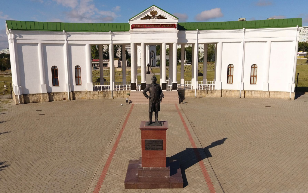
Monument to Field Marshal, Prince G.A. Potemkin-Tavrichesky
The entrance to this historical complex has been thoughtfully designed in the form of an elegant colonnade, before which stands a monument honoring G.A. Potemkin-Tavrichesky — one of the most celebrated and influential statesmen in Russian imperial history. This dignified architectural ensemble pays tribute to the visionary leader whose efforts to develop and secure Russia’s southern territories left an enduring mark on the entire region, including the lands that would become Pridnestrovie.

Memorial Sign to R.N. Gerbel
The monument to General Rodion (Rudolf) Gerbel was unveiled on October 8, 2011, fittingly timed to coincide with the 603rd anniversary of Bendery. Swiss by origin, Gerbel served within the Russian army as a specialist in military engineering, bringing his technical expertise to bear on one of the most decisive campaigns in the city’s history.
It was Gerbel who developed the strategic plan for the 1770 siege of Bendery Fortress — a plan executed with remarkable precision and skill. In just eight weeks, his engineers successfully constructed a tunnel reaching all the way to the fortress walls, where they laid 400 pounds of gunpowder. The resulting explosion proved devastatingly effective, filling in the defensive ramparts and inadvertently creating a kind of bridge across which Russian troops launched their attack, ultimately securing Bendery for the Russian Empire. Gerbel’s engineering genius thus played a pivotal, if largely behind-the-scenes, role in one of the most significant military victories in the city’s long and storied history.
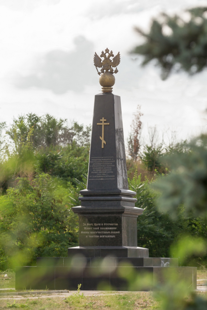
Monument to the Victims of the First World War
This monument honors the valor and sacrifice of Russian soldiers and officers who lost their lives in Pridnestrovie during the First World War. Located within the garden named after R. Gerbel at the walls of the fortress, the monument was specifically unveiled to mark the 95th anniversary of the famous 1916 offensive of the Southwestern Front — the campaign that would later become known to history as the Brusilov Breakthrough.
The First World War left its mark deeply on Bendery itself. The city served as the departure point for the 55th Podolsk Infantry Regiment as they set off for the battlefields, and following Romania’s defeat, Bessarabia transformed into frontline territory, drawing waves of refugees and wounded soldiers into the city. Some of these wounded found shelter and care in the People’s Lecture Hall, which had been specially adapted to serve as an infirmary during this difficult period. The significance of Bendery’s wartime role was further underscored when Emperor Nicholas II himself visited the city in 1916 during his trip through the region, lending imperial attention to the sacrifices being made on this corner of the front.
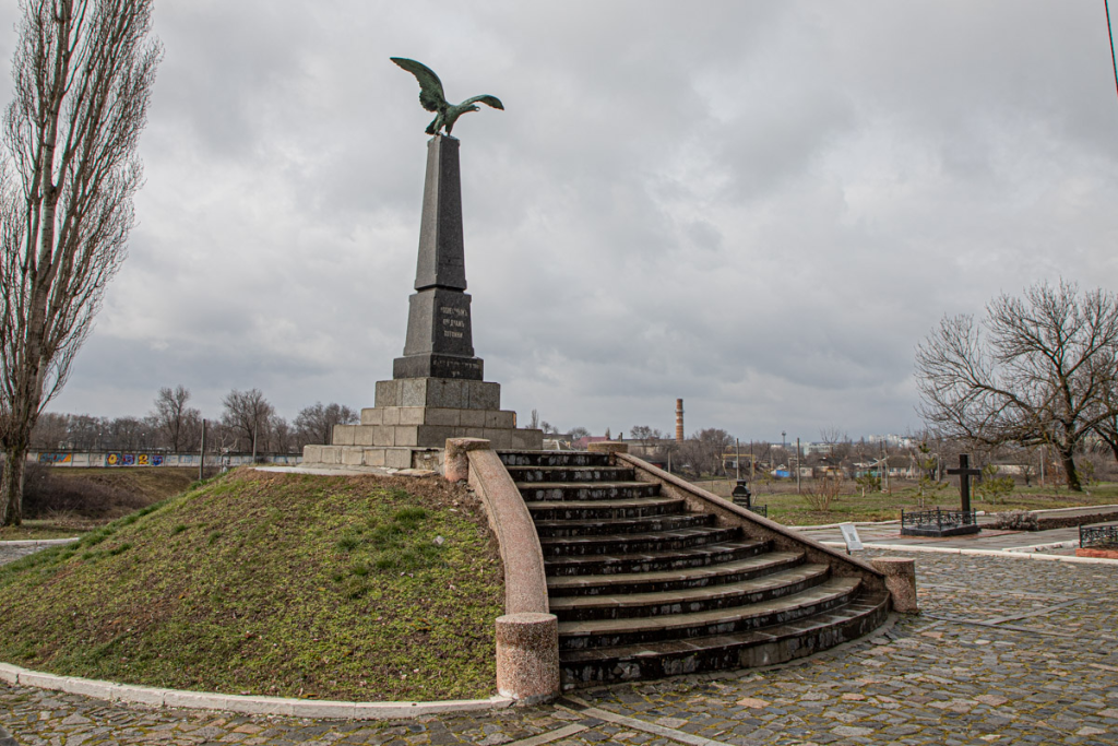
Monument to the 55th Podolsk Infantry Regiment in Bendery
In 1912, residents of Bendery celebrated a significant double anniversary: the centenary of victory in the Patriotic War of 1812 and the centenary of Bessarabia’s incorporation into Russia. To mark this momentous occasion, the inauguration of a monument to Russian military glory was specifically timed to coincide with these celebrations. The funds necessary for the monument’s construction were raised through the dedicated efforts of soldiers and officers of the 55th Podolsk Infantry Regiment, whose own military legacy the monument would come to honor.
Originally, the monument was positioned within the Bendery Fortress itself, situated alongside the Alexander Nevsky Military Church. During the Soviet era, however, the monument was relocated from the fortress to what is now Panina Street, where it continues to stand to this day — preserving the memory of this distinguished regiment even as its physical location shifted with the changing tides of history.
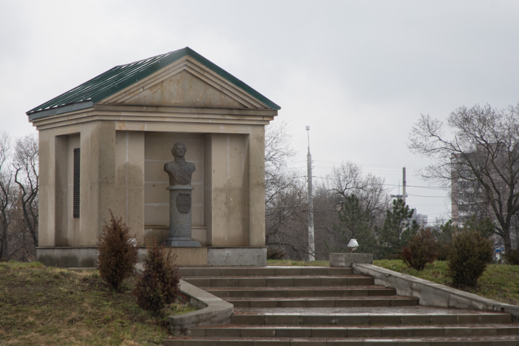
Bust of General-in-Chief P.I. Panin
On August 29, 2010, in commemoration of Bendery’s liberation from Turkish rule, a monument honoring Count Petr Ivanovich Panin was unveiled at the Main Gate of the Bendery Fortress. The monument stands along a street that city authorities renamed in honor of this distinguished Russian commander, recognizing his significant military achievements connected to the city’s history. The bust itself rests upon a granite pedestal positioned against the fortress’s closed chapel, stylized to evoke the artistic traditions of 18th-century monuments.
Panin dedicated more than 35 years of his life to military service within the Russian Imperial Army, participating in campaigns against the Swedes and Crimean Tatars while distinguishing himself on the battlefields of the Seven Years’ War. In recognition of his military service, in 1769, during the Russian-Turkish War, Empress Catherine II appointed him commander of the 2nd Army, charged with the critical mission of capturing Bendery and securing Russia’s southern border.
On September 15, 1770, Panin’s troops launched a decisive assault on the formidable fortress, ultimately capturing it after fierce and costly fighting. Despite this significant military achievement, the heavy losses sustained during the assault drew a negative reaction from the Empress, prompting Panin to resign his command. Nevertheless, many military engineers have since regarded the siege of Bendery as an exemplary military operation from beginning to end — a testament to Panin’s tactical skill, even amid the campaign’s tragic human cost.
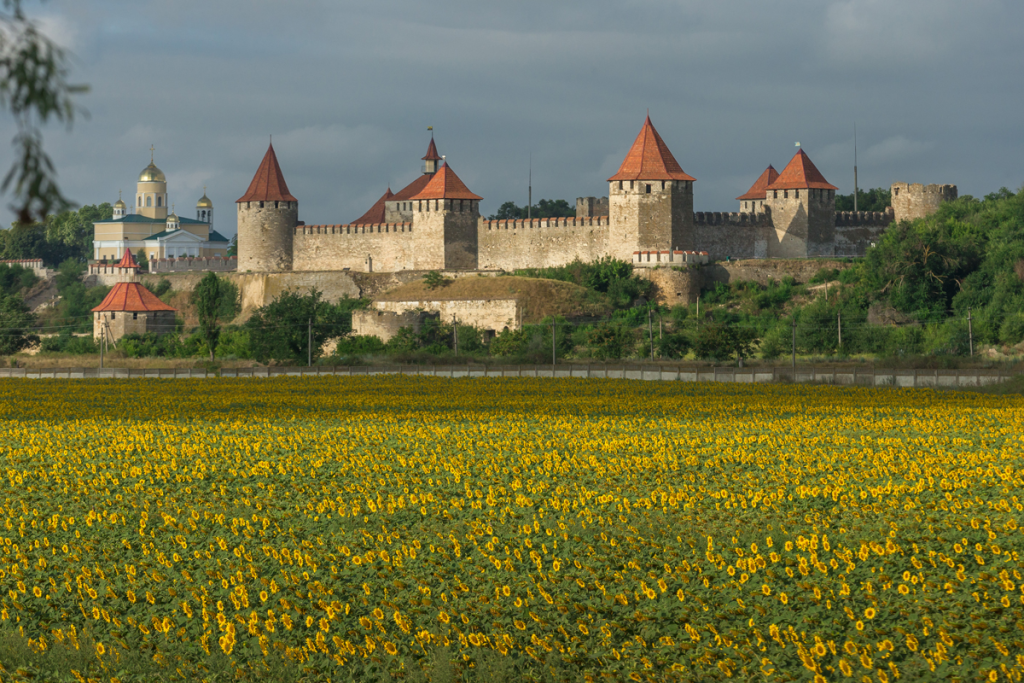
Bendery Fortress
Bendery Fortress ranks among the oldest structures in all of Pridnestrovie, standing as an outstanding monument to the art of fortification architecture. The citadel’s original core was constructed by medieval Genoese builders, and following Bendery’s incorporation into the Ottoman Empire in 1538, Turkish engineers significantly rebuilt and expanded the castle into the formidable structure that would shape the region’s military history for centuries to come. Remarkably, the citadel has survived in nearly its original form, complete with all 8 of its original towers — a testament to the quality of its construction and the determination of those who maintained it.
Throughout its long history, the fortress proved formidable indeed: neither Cossack forces nor the armies of Moldavian rulers ever succeeded in breaching its walls. During the Russian-Turkish wars spanning the 18th and 19th centuries, the fortress found itself caught in the very heart of the struggle between two great empires, changing hands three separate times as Russian troops successfully captured it. Once Bendery became part of the Russian Empire, the fortress took on new purpose, serving as a vital stronghold for the Russian army.
Today, visitors can explore a Historical Museum housed within a remarkably well-preserved ancient powder cellar of the citadel, complemented nearby by a Museum of Medieval Torture Instruments and a souvenir shop offering mementos of this remarkable visit. Surrounding the citadel, an impressive collection of monuments honors historical figures whose lives intertwined with the fortress and the broader history of Pridnestrovian land — including A.V. Suvorov, M.I. Kutuzov, P.A. Rumyantsev-Zadunaisky, P.Ch. Wittgenstein, M.B. Barclay de Tolly, N.N. Raevsky, M.G. Miller and Ya.P. Kulnev.
At the southern wall of the citadel stands the Pantheon of Russian Military Glory, featuring busts of distinguished commanders from the Russian Imperial Army. A separate memorial site, opened in 2010, pays tribute to Baron Karl Friedrich Hieronymus von Münchhausen, a captain in the Russian Imperial Army who participated in the 1738 campaign against Bendery Fortress. True to the legendary tales chronicled by R.E. Raspe, visitors can even find a symbolic cannonball here — the very one upon which, according to popular legend, the famous Baron supposedly took flight during the siege of the fortress, adding a touch of whimsical storytelling to this otherwise deeply historical site.

Church of the Faithful Saint Prince Alexander Nevsky
The Alexander Nevsky Church, constructed in 1833 in the Byzantine architectural style, holds the distinction of being the only functioning military church in all of Pridnestrovie and ranks among the oldest religious buildings in Bendery. Throughout its long history, this resilient church survived the upheaval of the 1917 revolution, as well as the difficult periods of Romanian and fascist occupation that followed, weathering decades of political and military turmoil.
During the Soviet years, the church followed the familiar fate of so many other Pridnestrovian religious buildings — Orthodox services ceased entirely, and the structure was repurposed as a soldier’s club, a function it served until the mid-1990s. The path back to its original sacred purpose began with a thorough three-year reconstruction, culminating in the church’s grand reopening on October 12, 2011.
The following year brought another significant milestone, as parts of the relics of Prince Alexander Nevsky himself were delivered to the church, deepening its spiritual connection to the saint for whom it was named. The church’s importance was further underscored in September 2013, when Patriarch Kirill of Moscow and All Russia personally visited, preaching to the parishioners and presenting the church with an icon of the Virgin Mary, Guarantress of Sinners, as a meaningful gift.
By the end of that same year, the church’s walls and dome received their painted decoration, completed by a dedicated team of Pridnestrovian artists who faced a genuinely challenging task — almost no historical information survived describing the church’s original interior decoration. Working largely from their own informed judgment, the painters drew inspiration from traditional Russian design, selecting ochre and gold as their primary colors while carefully considering the building’s distinctive identity as a military church throughout their creative process.

Transfiguration Cathedral, Bendery
A major reconstruction of Bendery began once the city became part of the Russian Empire, with urban planners deciding to rebuild the city at some distance from the original Bendery Fortress. In 1814, authorities decided to relocate the Dormition and Nikolsky churches to this new city center, but their dilapidated condition ultimately led to their demolition instead. The city then turned its attention to constructing an entirely new Transfiguration Cathedral, with His Grace Dimitrios, Bishop of Bendery and Akkerman, serving as the project’s founding figure.
The cathedral’s foundation stone was laid on August 22, 1815, and Bishop Dimitrios personally consecrated the building in 1827 — though construction itself proceeded at a notably slow pace. The bell tower wasn’t completed until 1832, and remaining construction work dragged on until 1840. Interestingly, the funding for completing construction came through a rather worldly arrangement: the church warden secured permission to build commercial shops surrounding the cathedral, with the resulting rental income providing the necessary financial support. This commercial activity left a lasting mark on the area, transforming the cathedral’s surroundings into a thriving trade center — indeed, the Bendery city market continues to operate nearby to this very day.
For many years, only a handful of small bells hung in the cathedral’s bell tower, until 1911 brought a significant upgrade: a large 3-ton bell, cast specifically at a factory in Nemirov. Remarkably, the cathedral’s interior remained unpainted well into the early 20th century — despite periodic repair work, the interior decoration project was never fully completed during this period. This changed in the early 1930s, when clergy decided to commission proper interior painting and invited the celebrated Moldavian artist and sculptor Alexandru Plamadeala to undertake the work. The artist arrived in Bendery around May 1934 to begin this ambitious project, bringing along four talented apprentices: V. Polyakov, V. Nechaeva, N. Kolyadich and A. Madval. Many of Plamadeala’s frescoes have survived remarkably well to the present day, including depictions of “Constantine,” “Helena,” “the Sun God,” and images of the twelve apostles — a lasting artistic legacy from this productive collaboration.
The cathedral suffered significant damage during the Great Patriotic War, when the building was struck by an artillery shell. The resulting fire destroyed both the iconostasis and the cathedral’s archive, permanently erasing invaluable historical information about the parish and city’s pre-war life. In 1948, recognizing its architectural and historical significance, the state placed the cathedral under official protection as an architectural monument dating to the early 19th century — ensuring this resilient survivor of war and time would be preserved for future generations.

Bendery Local History Museum
The Bendery Local History Museum opened its doors on December 11, 1914, earning the distinction of being the oldest museum in all of Pridnestrovie. The museum building itself stands as one of the most striking and architecturally expressive structures in Bendery, its design alone making it a notable landmark worth visiting.
Within its walls, visitors will discover an extraordinary collection of genuine rarities spanning centuries of history. The museum houses original medieval manuscripts, ancient tools and household items, and a remarkable dugout boat dating to the first half of the 15th century, discovered along the banks of the Dniester River near Bendery. Among the museum’s most prized archaeological treasures are antique amphorae dating back to the 4th century BC, alongside a fragment of marble slab bearing a Turkish inscription, originally taken from the main gate of the 16th-century Bendery Fortress. The collection further includes medieval copperware and weapons from the Russian-Turkish wars, together offering visitors a comprehensive material record of the diverse civilizations and conflicts that have shaped this remarkable city across more than a millennium.

Monument to A.S. Pushkin
The great Russian poet Alexander Pushkin visited Bendery on two occasions, in 1821 and again in 1824, during the period of his exile to the southern reaches of the Russian Empire. During these visits, Pushkin found himself particularly fascinated by the historical connection between Bendery and Swedish King Charles XII, who had once stayed in the city, as well as the reputed grave of Hetman Mazepa, said to be buried somewhere near the city’s outskirts.
This connection between Pushkin and Bendery left lasting marks on the city’s identity: historically, the main city park and the People’s Lecture Hall both bore the poet’s name. Today, this legacy continues through one of Bendery’s central streets, which carries Pushkin’s name and on which his monument now stands. Nearby, Gymnasium No. 2 and the central library similarly honor the poet through their own naming, creating a cluster of cultural institutions connected to his memory.
The monument to Pushkin itself was inaugurated on June 5, 1980, deliberately timed to coincide with the 160th anniversary of the poet’s first visit to Bendery. Pushkin’s own literary works preserve a record of his impressions from this visit, most notably in his epic poem “Poltava” (1828), where he wrote evocatively of the landscape surrounding Bendery: “For where the rows of winged mills in clusters form a peaceful fence around the desert peals of Bendery, where horned buffalo roam free about the graves of warriors—” These verses capture the poet’s romantic impression of this borderland city, forever linking his literary legacy to the landscape and history of Bendery.

Agroprombank Branch (Former Residential Building of Notary Matveyev)
This architecturally expressive building holds recognized status as a historical monument, built in eclectic style enriched with elements of Art Nouveau design. Constructed in 1910, the building has played an important role in shaping the historical appearance of the city’s central district, its distinctive facade contributing to the overall architectural character of this part of Bendery.
The building’s history began when notary Georgy Matveev constructed the house directly opposite the uyezd zemstvo (local self-government body) on Pushkina Street. The Matveev family continued living here until 1937. From 1940 to 1972, with the notable exception of the war years, the building served a very different function, housing the city Committee of the Communist Party — a significant shift from its origins as a private residential building.
In the post-war period leading up to 1972, this connection to party administration continued, after which the building transitioned to house the House of Scientific and Technical Propaganda and the Knowledge Society, reflecting the changing priorities of Soviet civic institutions over time.
In 1991, the building entered its current phase, becoming a branch of the Agroprombank of Pridnestrovie. Today, alongside the bank, the building also hosts the Bendery branch of the Registration Chamber of the Ministry of Justice of the PMR, continuing this historic structure’s long tradition of serving important administrative and financial functions for the city.
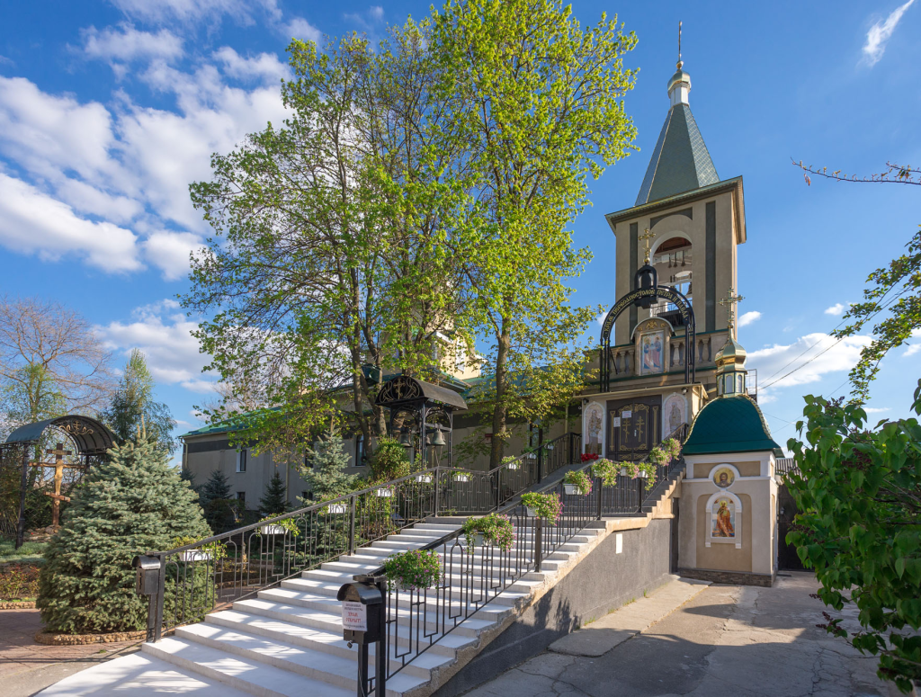
Convent of the Holy Apostles Peter and Paul
In the middle of the 19th century, Marcellin Olshevsky, who served as commandant of the Bendery Fortress with the rank of Lieutenant General, initiated construction of the first Catholic Church of the Holy Apostles Peter and Paul in Bendery. As time passed, however, the local Catholic population gradually diminished, and by the end of the 1870s, the building transitioned to Orthodox use. The Orthodox parish of Peter and Paul subsequently flourished, continuing its religious activities right up until the outbreak of the Great Patriotic War.
During the post-war period, the church buildings underwent numerous reconstructions and were repurposed for various functions, reflecting the changing needs and priorities of this era. The path back to religious use began on July 9, 1997, when the church building was formally returned to the Orthodox community, and by 2006, this had developed further into the establishment of the Convent of the Holy Apostles Peter and Paul on this historic site.
The story of this convent carries a particularly poignant connection to its founder: Lieutenant General Marcellin Olshevsky, who initiated the church’s original construction, died in 1866 and was buried in a tomb on the church grounds. In 1953, his remains were transferred to the cemetery, though a tombstone from his original grave remains preserved within the convent today, serving as a lasting memorial to the man whose vision first brought a place of worship to this site nearly two centuries ago.
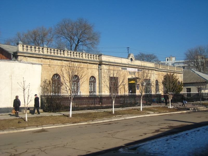
Medical College in Bender (Jewish Hospital in the Past)
This historic building owes its origins to entrepreneur Itskhok Nisenboim, who constructed a Jewish hospital here in 1889 — a comprehensive medical facility that served the city’s Jewish community with remarkable thoroughness. Within its walls operated a polyclinic, a pharmacy, a nursing home accommodating 40 to 50 beds, a shelter dedicated to the Jewish community and even a synagogue specifically for doctors and paramedics, reflecting the institution’s holistic approach to caring for both the physical and spiritual needs of those it served.
Architecturally, the building distinguishes itself through strict classical proportions and a careful attention to symmetry and decorative detail. The central entrance is elegantly framed with pilasters, while window openings feature decorative geometric patterns alongside graceful arched designs. Surrounding the entire structure, an openwork forged lattice adds a final touch of craftsmanship, harmonizing beautifully with the building’s overall facade and completing this fine example of late 19th-century architectural design dedicated to philanthropic medical care.
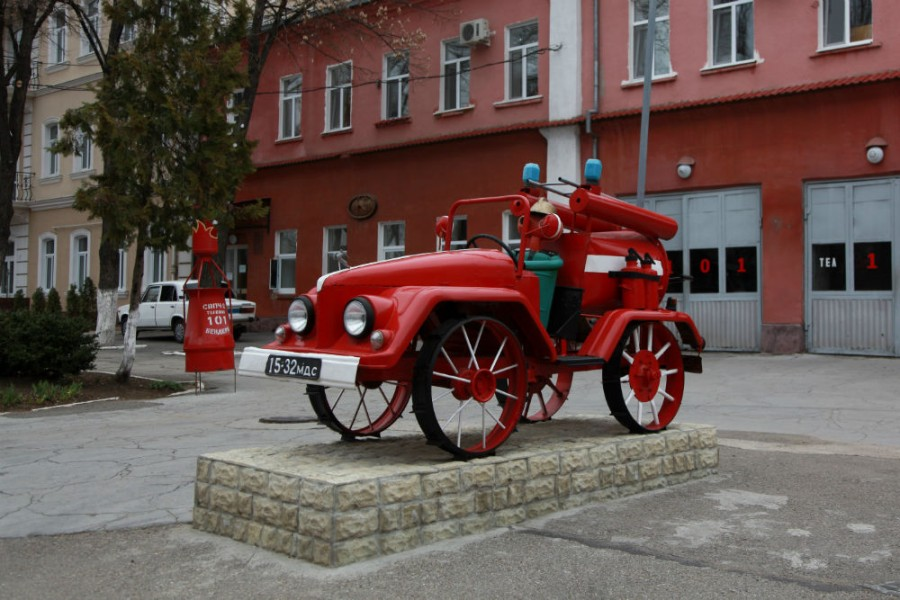
Fire Department Building
This building holds the distinction of being one of the oldest structures in Bendery, constructed in 1854 and remarkably having never changed its original purpose throughout more than a century and a half of continuous service to the city. Originally, the building was designed as a single-story structure, distinguished by a high tower that, unfortunately, has not survived to the present day.
The building’s profile changed significantly in 1955, when a second floor was added to the original structure, expanding its capacity while maintaining the building’s continuous dedication to fire department functions — making this an exceptional example of urban infrastructure that has reliably served the same essential civic purpose since the mid-19th century.
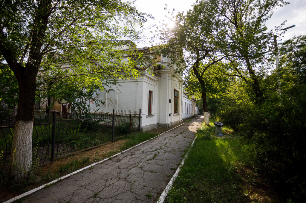
Auditorium Building
This building stands as a recognized monument of history and architecture, constructed at the beginning of the 20th century in 1902, designed in the distinctive style of late, or high, Russian classicism. For many decades following its construction, the Auditorium served as one of the most beloved and revered gathering places among Bendery’s residents, hosting recreation, entertainment, celebrations and elegant balls throughout the year.
During the period of Romanian occupation, the Auditorium took on particular cultural significance, becoming a vital center for Russian and Ukrainian cultural life in the city. Some of the era’s most celebrated performers graced its stage, including Petr Leshchenko, Yuri Morfessi, Vadim Kozin and Alexander Vertinsky — legendary names whose performances brought genuine artistic prestige to this venue.
The building’s history took a different turn during the First World War, when a military infirmary for wounded soldiers of the Southwestern Front was established within the Auditorium. In the spring of 1916, this significant medical role attracted notable attention when the family of the last Russian emperor visited Bendery, including a visit to the infirmary itself — connecting this cultural venue to one of the final chapters of imperial Russian history.
Following the collapse of the Soviet Union, the building unfortunately fell into a period of disrepair. Since the 1990s, however, the structure has found renewed purpose, now given over to the Bendery Art College, ensuring that this historically and architecturally significant building continues to serve the cultural life of the city, albeit in a new educational capacity.
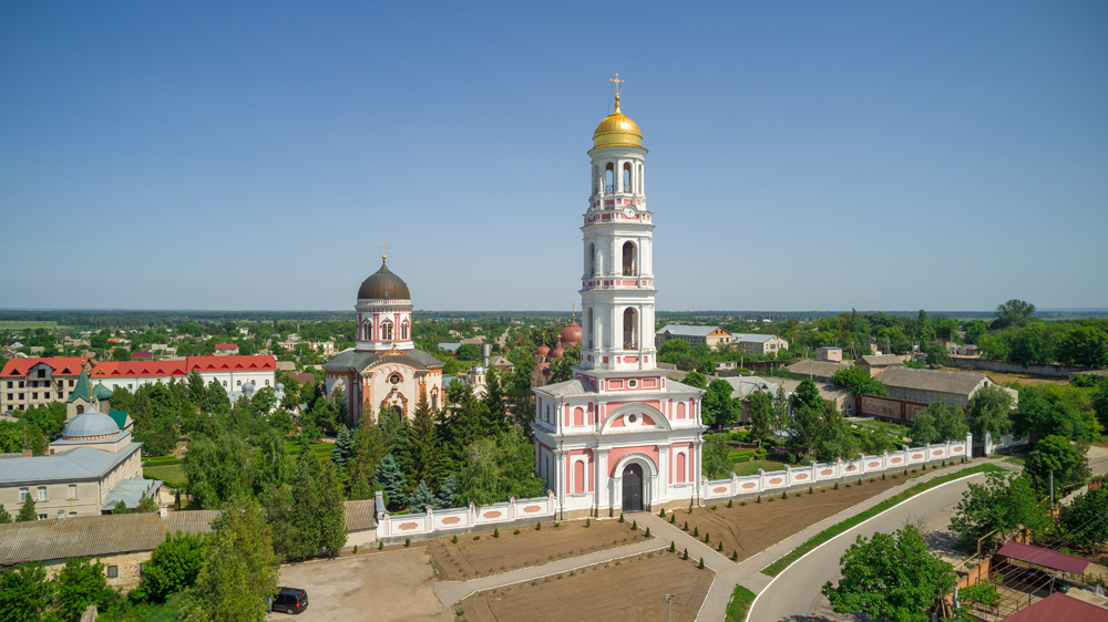
Holy Ascension Novo-Nyametsky Monastery
Situated in the heart of Kitskany village, the Holy Ascension Novo-Nyametsky Monastery stands as an outstanding masterpiece of Orthodox Church architecture. The monastery ensemble comprises four distinct churches: the Holy Ascension Cathedral, used in summer; the Assumption Church, designed for winter worship; St. Nicholas Church, serving the monastery’s seminary; and the Church of the Exaltation of the Cross, which functions as the refectory. Beyond its sacred buildings, the complex offers accommodations for visiting pilgrims, houses a dedicated church museum, operates a working printing house and maintains an icon-painting workshop, alongside an extraordinary library preserving documents, miniatures and rare books spanning the 15th through 19th centuries.
The true crown jewel of the monastery is its magnificent five-tiered bell tower, soaring 69 meters into the sky and offering breathtaking panoramic views across the surrounding countryside. The tower’s largest bell is a true giant, weighing an impressive 8.5 tons.
The monastery’s origins trace directly back to the renowned Neamt Monastery, one of the great medieval centers of Moldavian culture and learning. Following the unification of the Moldavian Principality with Wallachia and the formation of Romania, the new authorities pursued a policy of secularizing Church lands, altering monastic statutes and even banning worship conducted in Church Slavonic. Fleeing this persecution, the monks sought refuge in the Russian Empire, and in 1864 received the highest official permission to establish the Novo-Nyametsky Monastery on this site. Construction of the full monastery complex would continue for nearly 50 years.
The Soviet period brought tremendous hardship to the monastery — its priors faced persecution, with some subjected to outright repression. In 1962, the monastery was forcibly and permanently closed, and its iconic bell tower, which had served as a military observation post during the war, was repurposed as a Museum of Military Glory dedicated to the Iasi-Chisinau Operation. It wasn’t until 1990 that the monastery finally resumed its religious activities.
Thanks to the dedicated efforts of Father Superior Dorimedont (Cecan), the churches, bell tower and monastic cells underwent careful renovation, a religious school was established, and a chapel was founded in honor of the miraculous icon of the Mother of God from the original Novo-Neamt Monastery, used specifically for the blessing of water. Today, the beautifully restored library building also serves as home to a museum dedicated to the monastery’s rich and resilient history.
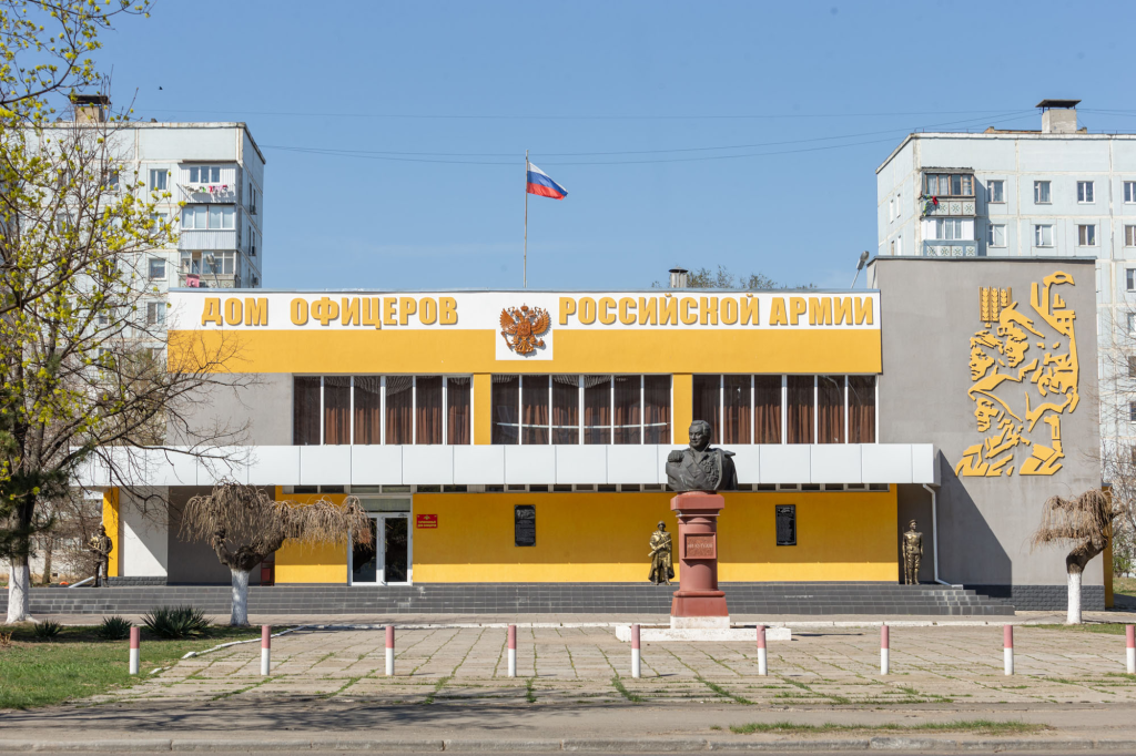
Bust of M.I. Kutuzov
This bust honors the great Russian commander Mikhail Illarionovich Golenishchev-Kutuzov, who served as Commander-in-Chief of Russian forces during the Patriotic War of 1812. The monument was erected in Tiraspol in 1997, positioned at a location of particular historical significance — precisely this spot once served as the parade ground of the Tiraspol fortress, from which the 56th Zhitomir Infantry Regiment and the 8th Astrakhan Dragoon Regiment departed to fight against Napoleon’s forces.
Both of these distinguished military units fought with remarkable valor during the decisive Battle of Borodino, their heroism earning them the personal gratitude of Emperor Alexander I himself. To commemorate these significant historical events, the city square occupying the site of the former parade ground was named Borodinskaya Square, ensuring that this connection to one of the most pivotal battles in Russian military history remains permanently embedded in Tiraspol’s urban landscape and collective memory.

Powder Cellar of the Saint Vladimir Bastion
The Sredinnaya Fortress was laid down on June 22, 1793, with the personal involvement of legendary commander Alexander Suvorov, built according to a design by engineer-architect Franz De Wollant. Within the fortress grounds stood the Church of St. Andrew the First-Called, three artillery parks, a military hospital, the commandant’s house, powder cellars, barracks, stables, and various ammunition and supplies depots — together forming a comprehensive military complex essential to defending this strategic frontier position.
Following the results of the 1812 Treaty of Bucharest, the Russian border shifted to the Prut River, causing Tiraspol to lose its significance as a borderline defensive position. As a result, the Sredinnaya Fortress was officially abolished in 1835. The fortress buildings suffered further damage decades later, during the construction of the Suvorovsky neighborhood of Tiraspol in the 1970s, which significantly altered this historic site.
Today, only the powder cellar of the St. Vladimir Bastion has survived from the entire fortress complex, and since 2014, this remaining structure houses the Museum of the History of the Tiraspol Fortress. In recent years, the powder cellar has become a traditional starting point for City Day celebrations, connecting modern civic festivities to this historically significant location. Recognized as the oldest building in the city and the sole surviving portion of the former Sredinnaya Fortress, this powder cellar holds particular importance as the structure whose construction is considered the very starting point of Tiraspol’s history — making it an essential touchstone for understanding the city’s origins.

Officers' Club of the 8th Astrakhan Dragoon Regiment
This distinctive building was constructed at the end of the 19th century, its entrance distinguished by a rich decorative attic, embellished with stone panels that immediately draw the eye. While the wall surfaces and window openings themselves feature relatively sparse decoration, the building more than compensates through an abundance of decorative and applied art elements — wrought-iron gates, a wicket and a canopy all demonstrate the considerable skill and craftsmanship of those who created this structure.
The building’s stylistic similarities to nearby barracks buildings suggest that the club was originally constructed by the Astrakhan regiment specifically for their own use, with construction likely completed no later than the 1890s. This connection to military social architecture places the building within the broader tradition of officers’ clubs that served as important gathering spaces for military leadership throughout the Russian Empire, providing spaces for socializing, relaxation and camaraderie among the officer corps stationed in this strategic frontier city.

Profitable House and Sausage Factory of S.K. Epifanov
At the beginning of the 20th century, located at what was then 108 Pokrovskaya Street (now 21 October 25th Street), stood a combined “profitable” house and sausage factory belonging to S.K. Epifanov. This type of building, common in pre-revolutionary commercial architecture, served a dual purpose: generating rental income from residential or commercial spaces while simultaneously housing Epifanov’s sausage manufacturing operations.
This establishment offers a fascinating glimpse into the commercial and entrepreneurial life of Tiraspol during the imperial era, when the city’s growing merchant class diversified into various manufacturing and food production enterprises, contributing to the broader economic development that characterized this period of the city’s history.

The Building of the Military Commissariat
This building has maintained an unbroken connection to military administration throughout its entire history. Historical maps from 1903 already labeled the structure as the “Military Presence,” indicating its established role in the city’s military infrastructure even at that early date.
Remarkably, the building continues to serve essentially the same function today as it did more than a century ago — currently housing the city’s military enlistment office. This continuity of purpose across more than 100 years makes the building a genuinely rare example of urban infrastructure that has remained dedicated to its original administrative function despite all the political and social changes that have swept through the region during this extended period.
Ministry of Health of the PMR
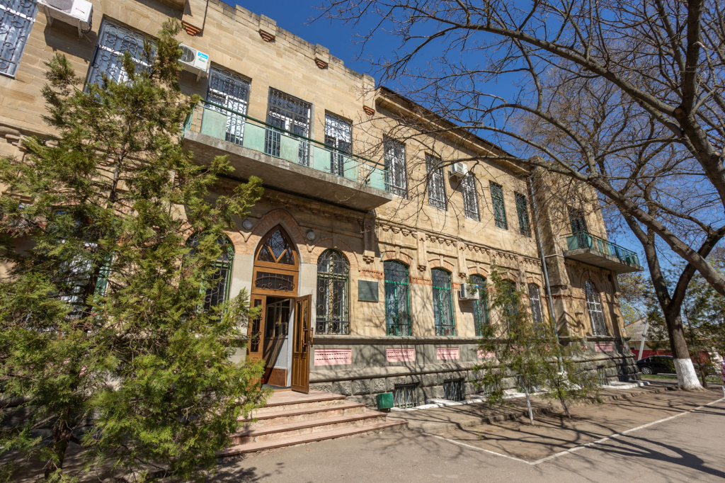
Pushkin Street preserves numerous buildings surviving from the pre-war period, with some historians considering it among the very first streets established in Tiraspol. Among the most architecturally interesting structures along this historic thoroughfare stands a building constructed in 1903 by architect A.M. Skorupko, originally designed to house local government bodies — specifically the Zemstvo Council and the City Duma. The building’s design follows the classical architectural style typical of southern provincial cities throughout the Russian Empire during this period.
The building underwent expansion in 1906, when a second floor was added to accommodate growing administrative needs. During the 1920s, the building took on a different role entirely, housing the headquarters of the 25th Moldavian Border Guard Detachment — a connection commemorated by a memorial plaque installed in 1975 to mark this military chapter in the building’s history.
Many longtime city residents also recall this building serving as a maternity hospital, adding yet another layer to its diverse functional history. Today, continuing this tradition of important civic service, the building houses the Ministry of Health of the PMR, ensuring that this historically significant structure continues to play a vital role in the administrative life of the republic.
House-Museum of Academician Zelinsky
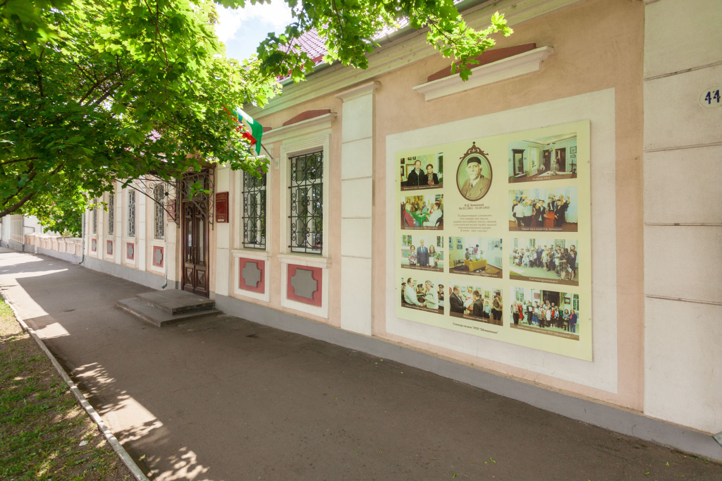
On February 6, 1861, Nikolay Zelinsky was born in this house, located right next to the Tiraspol United Museum. Zelinsky would go on to become a famous chemist, known worldwide as the inventor of the gas mask — a discovery that would save countless lives and establish his lasting scientific legacy. Today, this birthplace forms part of the Tiraspol United Museum complex, hosting a permanent exhibition titled “Life and Work of Academician N.D. Zelinsky,” assembled with the dedicated support of the scientist’s own descendants.
The museum’s four halls comprehensively present both the personal life and professional achievements of this great chemist. Visitors can explore a historical interior recreating a noble living room of the period, alongside Zelinsky’s own personal belongings — including books, laboratory utensils and a tailcoat that once belonged to him. The collection also features original photographs of Moscow University professors dating to 1911 and beyond, complemented by paintings and sculptures created by leading Soviet artists that capture the academician’s distinctive appearance and presence.
The building additionally houses a small exhibition hall for rotating displays. Since the opening of the Zelinsky house-museum, more than a million visitors have come through its doors, testament to the enduring fascination with this scientist’s remarkable life story and groundbreaking contributions to chemistry and public safety.

Historical and Local History Museum
This museum’s exhibits comprehensively reflect different periods throughout the life of both the region and the city of Tiraspol, offering visitors a broad historical perspective spanning numerous eras and developments. Beyond its static, permanent exhibitions, the museum maintains a dynamic exhibition schedule, opening up to ten temporary exhibitions annually within its lobby space, ensuring that even repeat visitors will always find something new to discover.
By the beginning of 2019, the museum’s collection had grown to substantial proportions, comprising approximately 90,000 items within its main fund, supplemented by more than 30,000 additional items held in its auxiliary scientific collection. This extensive holding makes the museum a genuinely significant repository of historical material, supporting both public exhibition and ongoing scholarly research into the region’s rich and varied past.
Tiraspol Math and Liberal Arts Gymnasium
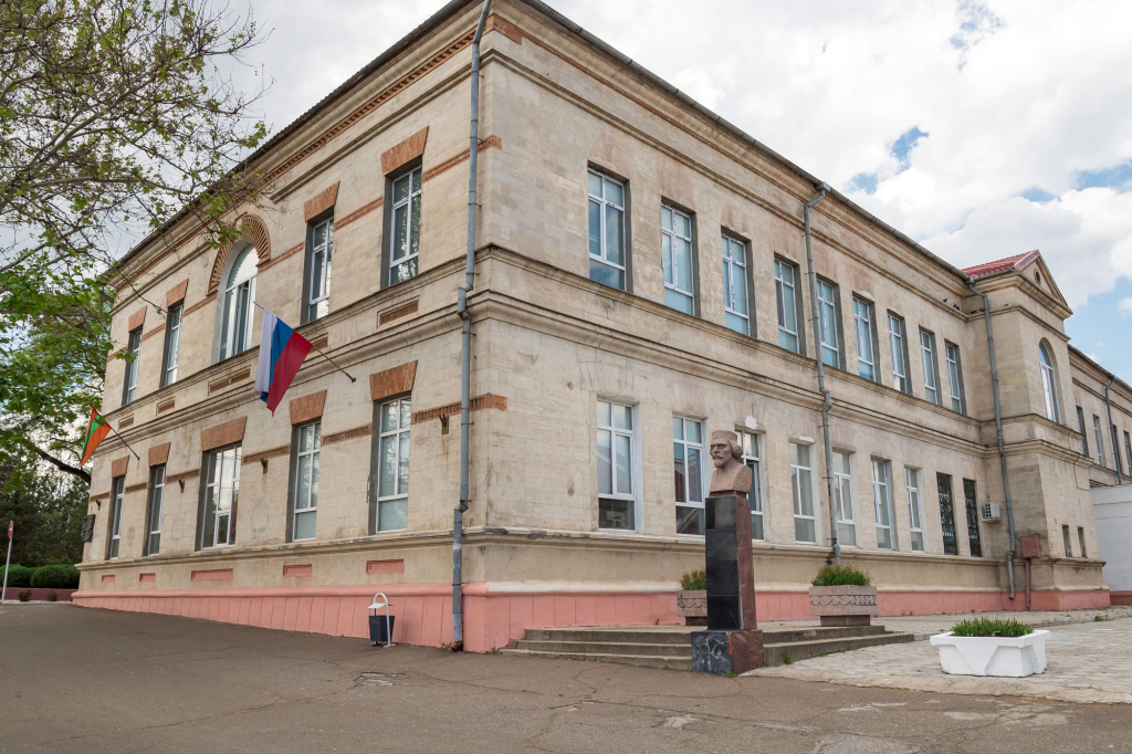
This institution holds the distinction of being the oldest educational establishment in the city, founded on February 24, 1893, initially operating as a progymnasium before transitioning into a women’s gymnasium in August 1900. The school occupied a building constructed at the city’s expense, becoming part of the broader system overseen by the Ministry of Public Education, with the academic year traditionally running from August 16 through June 1.
Students from all social classes attended this gymnasium, and many graduates of the women’s gymnasium went on to become teachers themselves, carrying forward their education by instructing future generations in primary schools throughout the region. During the Soviet period, the building continued serving its educational purpose without interruption, maintaining its commitment to teaching and learning activities. The building experienced what might be called a second life in 1949, when it underwent reconstruction following the devastation of the Great Patriotic War.
In 1961, the gymnasium received a new name, honoring the famous organic chemist Nikolay Zelinsky — connecting this educational institution to one of Tiraspol’s most celebrated native sons. The capital’s math and liberal arts gymnasium achieved its current official status in 1991, and to this day remains recognized as one of the finest general education establishments throughout the entire republic.
A bust honoring academician N.D. Zelinsky, one of the creators of the gas mask and a globally renowned Soviet chemist, stands prominently in the gymnasium’s courtyard. Fittingly, Zelinsky’s childhood home, which today operates as a museum, sits just opposite the gymnasium, creating a meaningful geographic connection between the scientist’s birthplace and the institution that bears his name.
Throughout more than 125 years of operation, numerous notable individuals have graduated from this gymnasium. Before the Great Patriotic War, several future Heroes of the Soviet Union studied within these walls: V.A. Bochkovsky, S.I. Poletsky, G.G. Cherniyenko, P.A. Shcherbinko and M.A. Pavlotsky — their wartime heroism following directly from the education they received here. Among the school’s other distinguished graduates are Heroes of Socialist Labor M.A. Koptilnikov, V.V. Solovieva and I.D. Dyachenko, demonstrating the gymnasium’s enduring legacy of producing individuals of exceptional achievement across multiple fields.

Monument to A.V. Suvorov
The monument to Alexander Suvorov stands as the defining hallmark of Tiraspol, a powerful expression of grateful descendants immortalizing the memory of the city’s very founder. This impressive monument was inaugurated more than 40 years ago, on November 23, 1979, with its unveiling deliberately timed to precede the celebration of the great commander’s birthday.
The towering 9-meter bronze statue itself was created by brothers Vladimir and Valentin Artamonov, while the overall monument design came from architects L. Druzhinin and Yu. Chistyakov, whose combined efforts produced what is widely recognized as one of the finest monuments to the Generalissimo anywhere in the former USSR. This recognition came with genuine artistic accolades: the monument received the gold medal named after sculptor Yevgeny Vuchetich — himself the celebrated creator of the famous “The Motherland Calls!” sculpture on Mamaev Kurgan in Volgograd — alongside the medal of the USSR Academy of Arts, cementing this Tiraspol monument’s place among the most distinguished works of Soviet monumental sculpture dedicated to this legendary military commander.
Catherine Park
To celebrate the 30th anniversary of the republic, Tiraspol underwent a remarkable transformation, emerging beyond recognition with the creation of the new Catherine Park, situated right in the very center of the capital city. The naming carries genuine symbolic weight, honoring the Russian Empress who signed the decree founding Tiraspol itself — connecting this modern green space directly to the city’s imperial origins.
The park’s defining feature is a striking 4.5-meter-high monument to the Russian Empress, a majestic half-ton bronze sculpture depicting Catherine II seated upon the throne of the Russian Empire. In this powerful representation, Catherine the Great holds the orb — the traditional symbol of monarchical state power — in her right hand, while her left hand grasps a document representing the construction order for the Sredinnaya Fortress, directly referencing the historical foundation of Tiraspol. This monument has been positioned opposite the bronze monument to Alexander Suvorov astride his horse, which has occupied the center of Tiraspol since 1979, creating a meaningful dialogue between these two foundational figures in the city’s history.
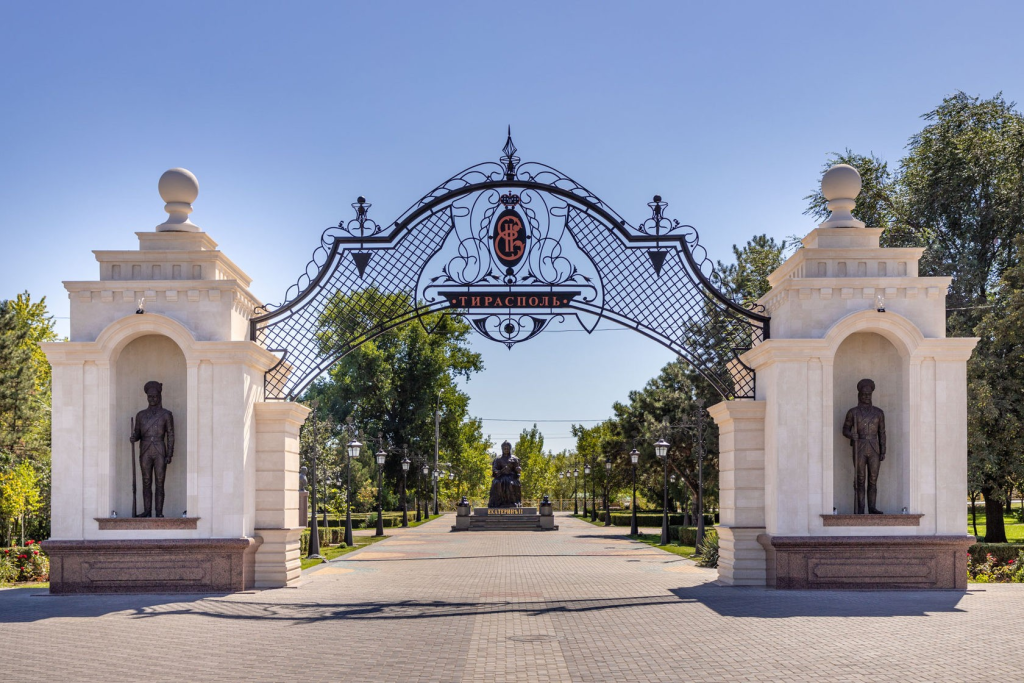
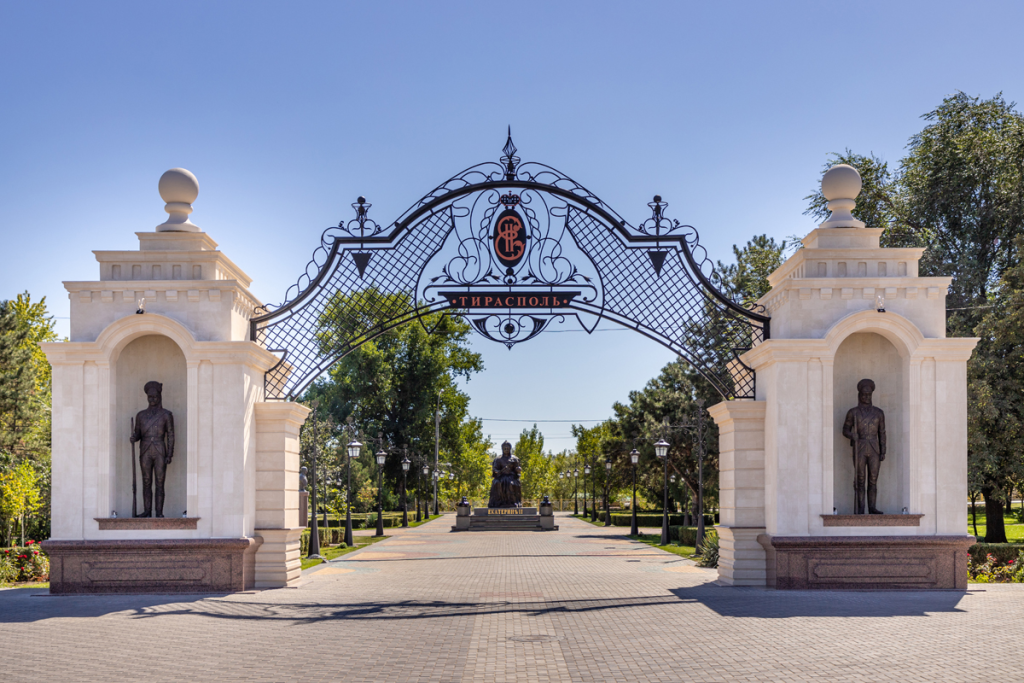
The park’s entrance groups take the form of elegant arches, uniting both sides of the park into a single cohesive composition. These arches function almost like portals, clearly marking the transition into the park’s distinctive atmosphere. The park itself offers a genuinely cozy environment for walking, meeting friends and capturing memorable photographs. Six fountains throughout the grounds receive beautiful illumination in the evening hours, while charming rotundas scattered throughout create an atmosphere reminiscent of bygone centuries.
Two small lakes grace the park’s landscape. Around the smaller lake, sports enthusiasts will find ample opportunity for exercise and recreation, with football and basketball fields, jogging tracks, table tennis tables, pull-up bars and even a rollerdrome all available. Near this same lake stands a miniature representation of the Sredinnaya Fortress, a fitting tribute given that the future capital of Pridnestrovie was constructed around the walls of this very fortress more than 200 years ago. The larger lake serves as home to a charming family of white swans, adding a touch of natural elegance to the park’s waterscape.
Rounding out the park’s offerings is the children’s amusement park “City of Miracles,” delightfully decorated with forged metal characters drawn from beloved and famous cartoons, ensuring that Catherine Park offers genuine appeal for visitors of every age.

Old-Rite Church of the Intercession
The Old-Rite Church of the Intercession holds a genuinely unique distinction as the only church in Tiraspol that managed to avoid demolition throughout the Soviet years, making it an exceptional survivor among the city’s religious architecture.
Old Believers have inhabited Tiraspol since the very day of its founding, maintaining their distinctive religious traditions even amid periods of significant persecution. A turning point came in 1905, when Emperor Nicholas II published a decree strengthening religious tolerance, which effectively halted the persecution of Old Believers and granted them the right to construct their own religious buildings. Acting on this newfound freedom, Tiraspol authorities granted permission in 1907 for the construction of a new old-rite church on Chasovennaya Street, now known as Lunacharsky Street. Construction reached completion on August 1, 1914, marked by the consecration of the church’s bell tower.
During the challenging Soviet years that followed, devoted parishioners successfully defended their old-rite church, preventing authorities from closing this important spiritual center despite the broader anti-religious campaigns affecting churches throughout the region. Following the destruction of both the Nikolsky Cathedral and the Intercession Church elsewhere in the city, this old-rite church remarkably remained, for an extended period, the only existing religious building still standing in Tiraspol — a remarkable testament to the resilience and determination of its faithful congregation.

Hotel "Passage" in the House of the Guber Brothers, 1914
In 1914, located at what was then 15 Pokrovskaya Street, the Hotel “Passage” distinguished itself among the city’s accommodations through its notable cleanliness and order — qualities that earned this establishment a particular reputation for quality service during the pre-revolutionary era. Built within the house of the Guber brothers, this hotel represented an example of the commercial hospitality infrastructure that developed in Tiraspol during this period of urban growth and development, offering travelers a reliable and well-maintained place to stay in the heart of the city.
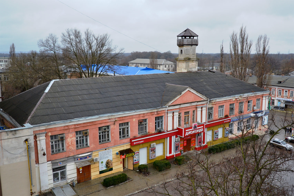
The Building of the Former City Council on Bazarnaya Street
At the turn of the 19th into the early 20th century, matters concerning the development and arrangement of Tiraspol fell under the purview of the city government, an institution led by individuals who left a lasting and noticeable mark on the city’s history. Among the most respected figures associated with this governing body was Semyon Pavlovich Timchenko, recognized as one of the most experienced employees within the city administration. Before his election as city mayor on September 30, 1890, Timchenko had already accumulated significant administrative experience, serving from 1867 to 1872 as secretary of the City Duma and director of the city bank, while also holding positions as a member of the city council before eventually assuming the mayoral role.
Under Timchenko’s leadership and broader participation in city management, Tiraspol saw the construction of its first water supply system and a dam, while also developing two parks, buildings for two public schools, Sunday schools and public libraries — a comprehensive program of civic improvement that significantly enhanced the quality of urban life for the city’s residents.
Throughout the second half of the 19th century and into the 20th century, the city government oversaw a vast and complex urban economy. A tangible reminder of this administrative era survives to this day in the form of the city watchtower, from which firefighters once surveyed the surrounding area, ready to sound the bell and drive out on carts to extinguish fires whenever danger threatened the city — a physical testament to the practical civic infrastructure that the city government worked diligently to establish and maintain.
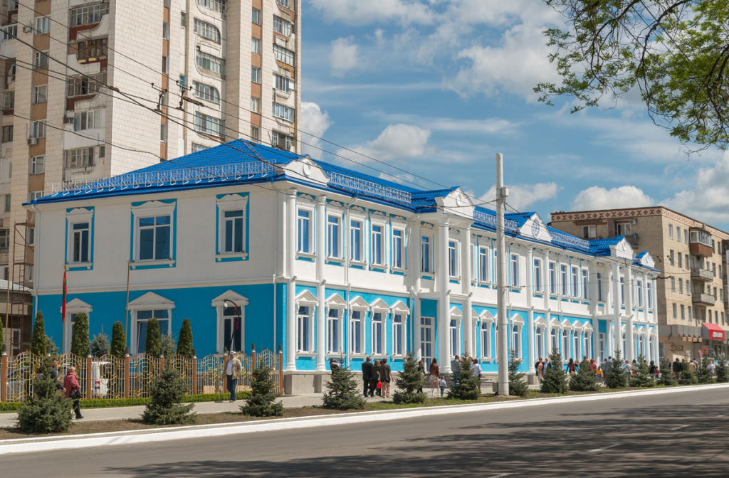
Building on Pokrovskaya Street (Medical Center "TiraMed")
This historic building has long served as a local landmark, playing a significant role throughout Tiraspol’s development across more than a century. Constructed on Pokrovskaya Street during the last quarter of the 19th century, the building was originally built by merchants to serve administrative needs, eventually becoming home to a commercial club where Tiraspol’s merchant community could gather. The growing commercial importance of Tiraspol throughout the 19th century contributed significantly to the flourishing of this merchant class, which was itself subdivided into different guilds based on available capital.
Members of the merchant class required a dedicated space for both business meetings and entertainment, and this building filled that role admirably. Visiting traders could stay in rooms with meals provided, while touring artists performed in the building’s halls for entertainment. In the evenings, a restaurant operated within the building, where merchants played billiards, discussed business matters, concluded important deals and held their annual reporting meetings. The commercial meeting hall also hosted New Year’s fancy-dress evenings for children, organized according to traditional biblical programming. Beyond purely commercial functions, the merchant class increasingly embraced patronage and charity during this period, becoming important supporters of Russian culture, science, technology and publishing.
The building’s purpose shifted with changing political times: in the 1920s, it housed a workers’ club featuring numerous circles and clubs, including a notable drama club. In the 1930s, architect M.E. Petrov oversaw a significant reconstruction project, adding a second floor to the building and opening a working clinic within its walls.
During the difficult years of occupation (1941-1944), while Nazi forces seized many of the city’s finest buildings for their own purposes, this particular polyclinic managed to retain its original medical functions, even though the chief physician during this period was a protégé installed by the occupation authorities. Remarkably, the head doctor’s cleaner, a woman named Kolesnichenko from Tiraspol, had daughters who were schoolgirls and secretly became members of the Tiraspol pioneer underground — a patriotic resistance group organized by Maria Skopenko, a Komsomol member from the city of Voznesensk. In the evenings, while helping their mother with cleaning duties, these brave young girls would close the doctor’s office from the inside and secretly listen to broadcasts from the Soviet Information Bureau using an existing radio. They carefully transcribed what they heard and pasted leaflets in crowded public locations, marking them with a red star in one corner and a red flag in another, ensuring people could recognize these messages of resistance from a distance.
In 1947, the building transitioned to house the city health department, and beginning in 1952, it operated as a full polyclinic. Today, continuing this long medical tradition, the building serves as the modern TiraMed Medical Center, carrying forward more than a century of service to the health needs of Tiraspol’s residents.
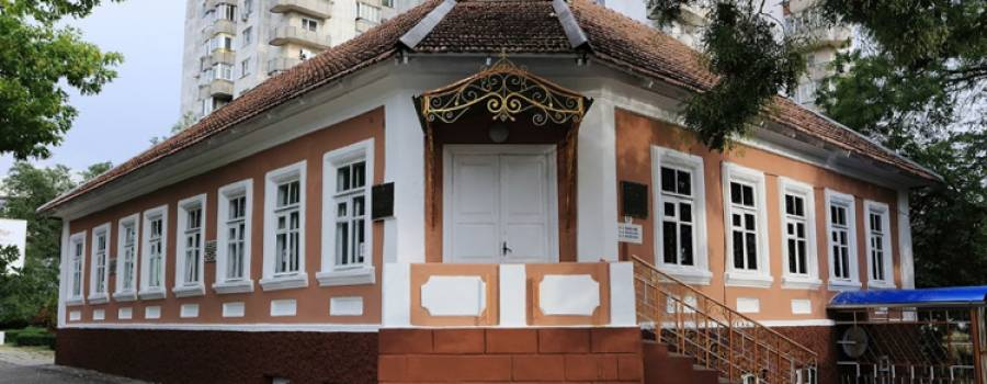
The Building of the Former Headquarters of the Cavalry Brigade G.I. Kotovsky
This historic building, located not far from the central post office, was originally constructed as the Hotel “Paris,” serving travelers and visitors to Tiraspol during an earlier era. The building’s role shifted dramatically in 1920, when it became the headquarters for the cavalry brigade commanded by Grigory Kotovsky, one of the most celebrated and colorful commanders of the Red Army.
During this period, Kotovsky’s forces played a significant role in the broader military campaigns of the Russian Civil War, taking part specifically in the overthrow of the Armed Forces of South Russia under the command of General A.I. Denikin. This connection to one of the pivotal military figures of the early Soviet era gives the former hotel building a significance that extends well beyond its original commercial purpose, marking it as an important site in the broader narrative of Tiraspol’s revolutionary and military history.

Railway Station Square
Railway Station Square ranks among the oldest squares in the city, with its formation dating back to the 1860s — specifically connected to the construction of the Tiraspol-Odessa railway line. Traffic on this important rail connection opened in 1867, accompanied by the construction of the railway station building itself, marking a significant milestone in Tiraspol’s transportation infrastructure development.
At the beginning of the 20th century, Russian Emperor Nicholas II visited Tiraspol along with Tsarevich Alexei, and during this visit, he received reports from city and district officials right at Station Square, before subsequently departing by train for Chisinau — connecting this square to a notable moment of imperial presence in the city’s history.
The Great Patriotic War brought considerable destruction to both Railway Station Square and the station building itself: during the Nazi retreat in 1944, occupying forces deliberately blew up the station building, leaving significant damage in their wake. The building underwent reconstruction in the 1950s, successfully integrating the rebuilt structure back into the landscape of the renovated square.
The square holds particular significance in more recent Pridnestrovian history as well: in September 1991, a women’s strike movement was born here, an event commemorated by a memorial plaque on the station building. During this remarkable demonstration, Pridnestrovian women blocked train movement through Tiraspol for an entire month, protesting the arrest by Moldovan authorities of then-President I.N. Smirnov — a powerful act of civil resistance that played a meaningful role in the region’s struggle for self-determination.
Tiraspol holds the distinction of being the first city in the region connected by rail to Odessa and its important port. In 1867, a railway was constructed from Razdelnaya station to Tiraspol, opening this crucial transportation link. Traffic on the Tiraspol-Chisinau line followed in 1873, further expanding the city’s railway connections to various parts of the country and cementing Tiraspol’s role as an important transportation hub within the broader regional network.
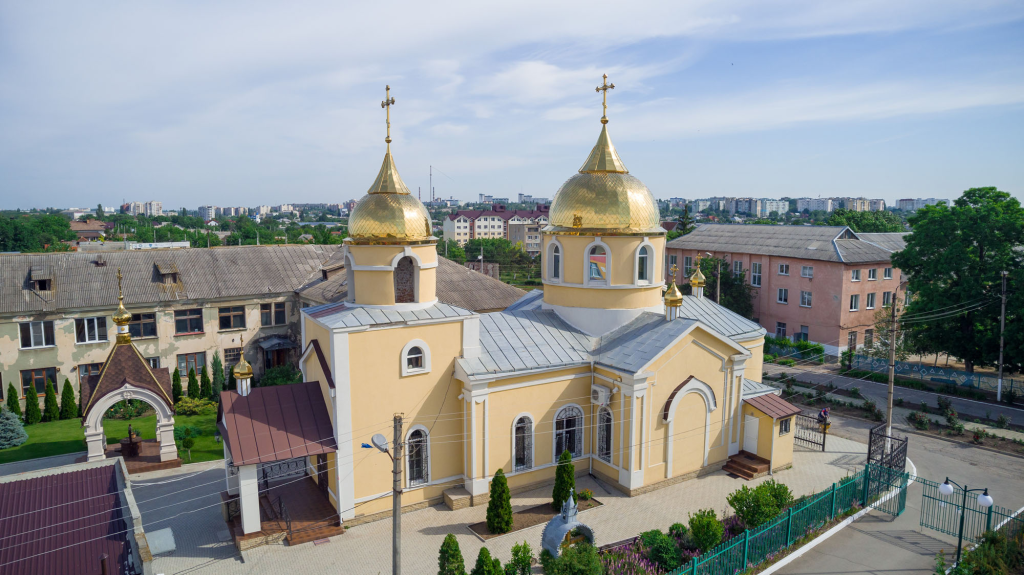
Church of the Holy Great Martyr Dmitry Salonsky
The Church of the Holy Great Martyr Dmitry Salonsky first appeared in Sukleya in 1866, establishing an important spiritual center for this village community. During the Soviet era, even before the outbreak of war, the church was forced to close, with the building subsequently transferred for use as a club. Throughout the 1940s and 1960s, the temple experienced a temporary revival, allowing services to resume for a period, but this proved short-lived — services eventually ceased once again, and the building underwent further transformation, first serving as storage facilities before ultimately being transferred to the local history museum.
The church’s path back to its original purpose began in 1990, when, responding to the requests of the faithful community, the church finally reopened its doors. Since this reopening, extensive restoration work has continued at the site: the altar has been rebuilt, and beautiful murals have been created throughout the church’s interior. In 2006, a carved oak iconostasis was installed, adding to the church’s restored splendor, and a few years later, new crosses and domes completed this remarkable journey of architectural and spiritual revival.
For more information, visitors may contact Archpriest Alexy Toma.

Church of the Kazan Icon of the Mother of God, Karagash Village
The Church of the Kazan Icon of the Mother of God stands as the defining landmark of Karagash village, with its construction dating back to 1909. Following a significant reconstruction, the church gained an impressive array of new features: elegant wrought-iron doors, a striking multi-tiered chandelier, comfortably heated marble floors and a beautiful new iconostasis, together transforming the temple’s interior into a space of genuine splendor.
All the icons displayed throughout the church were crafted by master artisans of the renowned Pochaev Lavra, one of Orthodoxy’s most celebrated monastic centers. Adding to their spiritual significance, some of these icons contain particles of holy relics, making them objects of particular veneration for the faithful who visit this church, drawing pilgrims seeking connection to these sacred remnants of saintly presence.

Church of Archangel Michael, Slobodzeya
The very first church in Slobodzeya was a modest wooden wattle structure with a reed roof, constructed back during the days of Turkish rule. This humble beginning gave way to something more permanent in 1804, when a new stone Church of Archangel Michael was built, funded through the generous donations of local parishioners committed to establishing a lasting place of worship for their community.
During the Soviet era, the building’s purpose underwent significant transformation — first converted into a community center, then closed entirely, before being transferred to the state bank during the post-war period. This series of secular repurposings meant the church spent decades disconnected from its original spiritual function.
By the late 1980s, spiritual life in Slobodzeya began experiencing a gradual revival. The Orthodox community, formally registered during this period, devoted considerable effort toward reclaiming the church building for the faithful, an objective finally achieved in 1990 when the building was officially returned to religious use.
Among the church’s particularly revered shrines, visitors will find the Icon of the Mother of God “Sorrowful” and the Icon of St. Stephen Slobodzeya (Kostogryz), both objects of special veneration within this historic congregation.
For more information, visitors may contact Archpriest Andrei Danilescu.

Church of the Intercession of the Blessed Virgin
This cruciform church was erected during the 1990s through the combined efforts of local residents and authorities, who worked together to bring a new place of worship to Chobruchi village. Villagers affectionately refer to this church as the “New” one, recognizing it as the spiritual heir to an earlier Intercession Church that had been built in Chobruchi back in 1809, before being destroyed during the Soviet era by the Bolsheviks.
This connection between the destroyed original church and its modern successor reflects a pattern common throughout Pridnestrovie, where communities have worked to restore religious life and rebuild spiritual continuity following decades of Soviet-era anti-religious policy, ensuring that villages like Chobruchi maintain an unbroken thread connecting their historical faith traditions to contemporary religious practice.

Memorial Sign in Honor of the Foundation of Grigoriopol
In 2005, a memorial sign — taking the form of a granite stone bearing an informational plate — was installed in the central park specifically to honor the foundation of Grigoriopol. This commemorative marker connects visitors directly to one of the most well-documented founding events in the region, as history has preserved not only the exact date of the city’s establishment — July 25, 1792 — but also rich details surrounding the festive occasion that marked this significant moment in the city’s origins.
This memorial sign serves as a meaningful touchstone for understanding Grigoriopol’s beginnings, offering visitors a tangible connection to the historical record of how this Armenian-founded city, established by decree of Empress Catherine II, came into being more than two centuries ago.

Grigoriopol School No. 2 named after A. Stoev
This historic 19th-century building, situated right in the heart of Grigoriopol, holds official recognition in the State Register of Monuments of Local Importance of Pridnestrovie — a testament to its enduring architectural and historical significance. Early 20th-century documents reference the building as the Alekseevskoe school, marking the beginning of its long educational legacy.
According to local historians, the building’s history before the revolution included service as a town council, before transitioning in the 1920s into a mixed gymnasium under the Odessa school district. By 1935, it had become a Ukrainian school, reflecting the shifting educational and administrative currents of the era.
Today, the building continues its educational mission as School No. 2, now bearing the name of Andrey Stoev — a native son of Grigoriopol who fell as a defender of Pridnestrovie during the period of Moldova’s military aggression. The school’s name stands as a lasting tribute to his sacrifice, ensuring that his memory remains woven into the daily life of the very community he gave his life to protect.
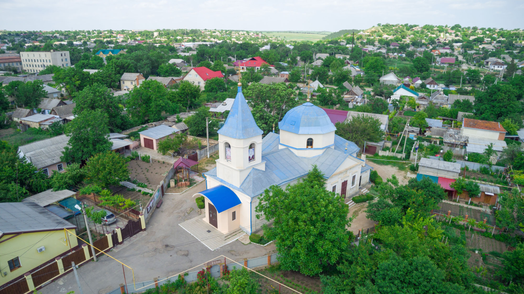
Church of the Ascension
The stone Church of the Ascension of the Lord in Grigoriopol was constructed in 1821 through the dedicated efforts of local parishioners who came together to build this important spiritual center for their community. The church’s history, however, was not without significant interruption — during the Soviet era, the temple was forced to close not once but twice, first in the 1920s and again in the 1960s, reflecting the recurring waves of anti-religious policy that affected churches throughout the region.
The church’s path toward restoration began in 1990, when the building was finally returned to the Orthodox community after decades of closure. Three years later, the roof underwent restoration, and just a year after that, the iconostasis was installed alongside the completion of the church’s interior painting, gradually bringing this historic structure back to its full spiritual and aesthetic glory.
Today, the Grigoriopol Church of the Ascension of the Lord holds official status as an architectural and urban planning monument of republican significance, placing it under formal state protection — a recognition that ensures this important piece of religious heritage will continue to be preserved for future generations.
For more information, visitors may contact Archpriest Nikolai Dzygovsky.
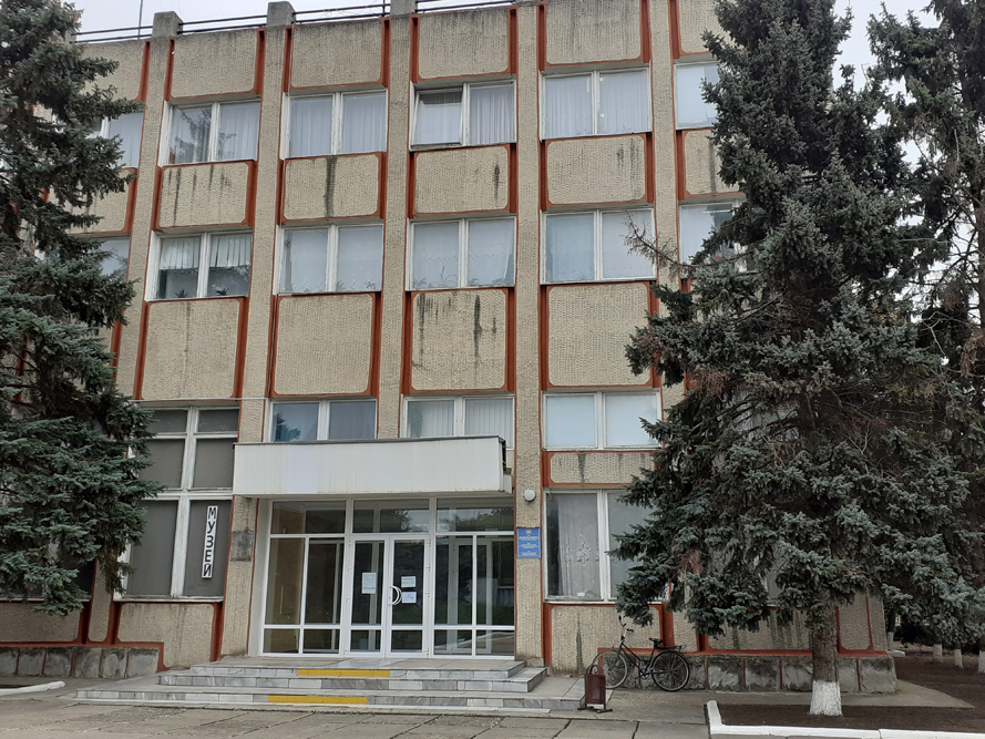
Historical Museum
The Historical Museum of Grigoriopol presents a comprehensive exposition dedicated to the city’s history, tracing its origins back to its founding by decree of Empress Catherine II in 1792. Among the museum’s most fascinating displays is a detailed diorama depicting Grigoriopol as it appeared at the end of the 19th century, offering visitors a vivid window into the city’s appearance during that historical period.
The museum also features a beautifully recreated exposition showcasing the interior of a traditional peasant hut, complete with authentic household items from that bygone era — bringing the daily rhythms of rural life to vivid, tangible life. Among the museum’s notable holdings is a copy of the original coat of arms of the city, which remarkably continues to serve as the official coat of arms of Grigoriopol to this very day, providing a direct visual link between the city’s founding and its modern identity.

Armenian Cemetery
Grigoriopol once had two Armenian cemeteries within its territory, though only the central one has survived to the present day — originally situated outside the city limits atop a high hill. This surviving cemetery now holds official status as a historical architectural monument dating to the late 18th century.
A walk among the preserved monuments and tombstones reveals a fascinating cross-section of society, with burials representing people of varying social classes. Some tombstones are crafted from ordinary stone, while others showcase valuable materials like marble and granite, reflecting the diverse fortunes of those laid to rest here. Among the cemetery’s treasures are several unusual and deeply symbolic monuments. One striking example takes the form of an open book carved from white marble, while another depicts a tree with branches deliberately chopped off and clearly visible roots rendered in gray marble — this particular monument marks the grave of a merchant and family patriarch whose family line ended with no male descendants to carry it forward. The tree’s substantial roots and sturdy trunk symbolize what was once a large and thriving family lineage.
The cemetery also features a memorial cross that holds particular significance for the Armenian community: every year on April 24, the Remembrance Day of the Victims of the Armenian Genocide, Armenians traveling from other cities visit Grigoriopol specifically to lay flowers at this site, honoring those lost in one of history’s great tragedies.
Over the generations, the assimilation of Armenian immigrant families into Grigoriopol’s broader community led to many surnames being rewritten in Russian style, and visitors will notice this linguistic blending reflected in the cemetery itself — tombstones bearing Russian-style surnames alongside names and patronymics that remain distinctly Armenian. The gravestones themselves often carry inscriptions in Grabar, the ancient Armenian language, with some featuring text in both Armenian and Russian side by side.
For visitors to Grigoriopol, the Armenian cemetery has become an essential stop — a place where guests can directly touch the history of the city’s origins as an Armenian colony established in southern Russia. They come specifically to see these unusual and evocative stones — tombstones and monuments that have stood on this land since the 19th century, silently preserving the memory of the community that built Grigoriopol from its very foundations.

Memorable Sign in Honor of the 220th Anniversary of the Diplomatic Ceremony of the Exchange of Ambassadors of the Russian Empire M.I. Kutuzov and the Ottoman Porte's Rashik Mustafa Pasha
In 2013, a substantial granite memorial weighing three tons was erected within the park, specifically created to commemorate one of the most striking and historically significant events to occur in Dubossary during the 18th century — the formal exchange of ambassadors between the Ottoman Porte and the Russian Empire.
This remarkable diplomatic ceremony was prescribed by the Treaty of Jassy, which called for a formal exchange of embassies to take place at the border near Dubossary. The Russian delegation was led by none other than M.I. Golenishchev-Kutuzov, who departed from St. Petersburg accompanied by an entourage of 68 persons, military teams and a substantial convoy numbering 600 people — a truly impressive diplomatic procession befitting the significance of the occasion.
Following carefully predetermined ceremonial protocol, the Turkish and Russian ambassadors met upon a raft positioned in the middle of the Dniester River itself, where they engaged in a brief conversation and formally exchanged their diplomatic credentials. This unusual meeting location — neither fully on Russian nor Ottoman territory, but symbolically suspended on the river separating their two empires — created a memorable and historically significant moment that this granite memorial now commemorates, connecting modern Dubossary to this fascinating chapter of 18th-century international diplomacy.
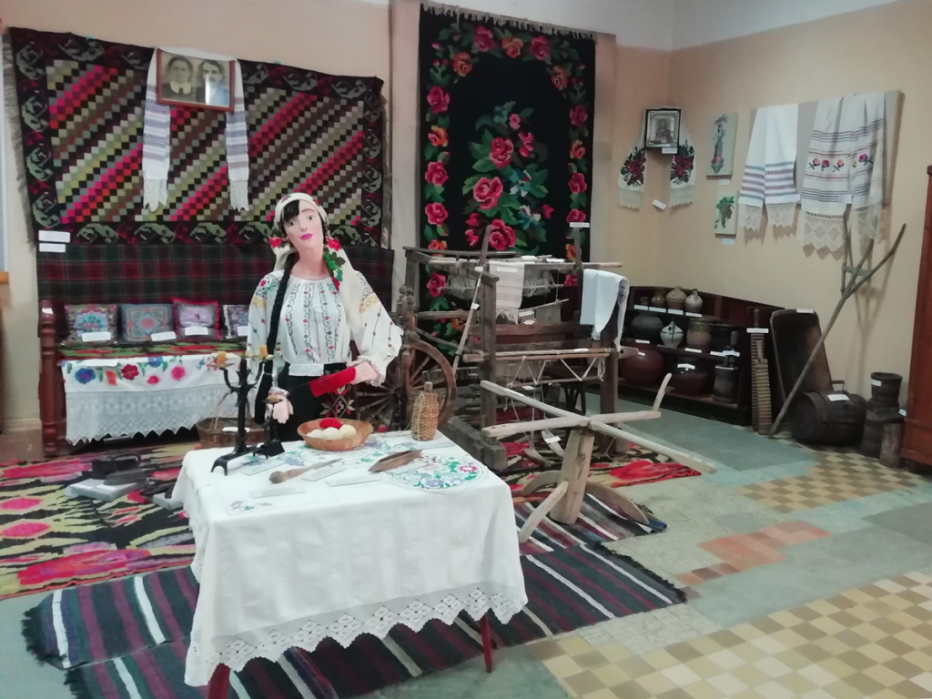
Historical and Local Lore Museum of Dubossary
The Historical and Local Lore Museum of Dubossary was founded in 1970 through a decision of the regional executive committee, initially established as a museum of revolutionary, military and labor glory operating on a voluntary basis. The impetus for creating the museum came from the rich material that regional pathfinders had collected through their dedicated search and research efforts, with the museum’s opening deliberately timed to coincide with the 25th anniversary of Victory in the Great Patriotic War.
On August 2, 1974, the institution received formal recognition, being granted the status of State Museum of History and Local Lore. Throughout the Soviet period, the museum earned a strong reputation, consistently ranked among the best regional museums in the entire Moldavian SSR — an achievement reflected in the numerous certificates and diplomas it received over the years. The Dubossary museum also holds the distinction of being among the first in Pridnestrovie to incorporate coverage of the 1990-1992 period of Moldova’s aggression against the Pridnestrovian Moldavian Republic into its exhibition work, ensuring this pivotal chapter of recent history found its place alongside older historical narratives.
On the eve of its 30th anniversary, in 2000, the museum relocated to its current two-story building at 9 Sovetskaya Street, where it continues to operate today. The museum’s exhibition space now spans approximately 325 square meters, while its broader collections contain more than 24,000 storage units in total — of which approximately 3,000 items are currently presented across the museum’s various exhibitions, offering visitors a rich and continually evolving window into the history of Dubossary and its surrounding region.

All Saints Cathedral
All Saints Cathedral ranks among the oldest churches in all of Pridnestrovie, its founding dating back to April 25, 1797, established with the blessing of Metropolitan Gabriel of Dneprovsk and Tauride (Bonulescu-Bodoni). This remarkable longevity places the cathedral at the very heart of Dubossary’s religious heritage, its history spanning more than two centuries of continuous spiritual significance for the local Orthodox community, weathering the many political and social changes that have swept through this region across the generations.
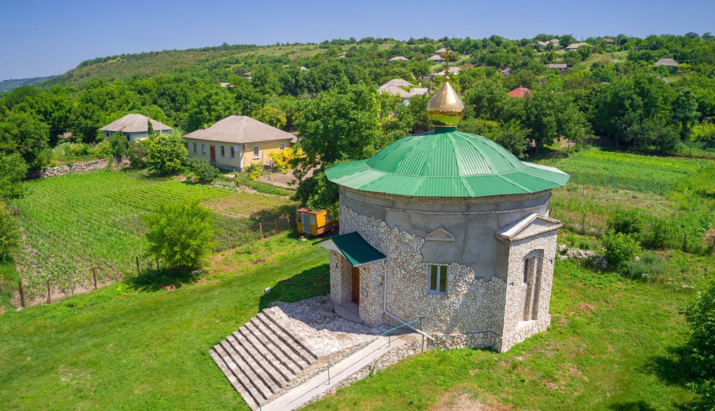
Church of St. Paraskeva Serbian, Zozulyany Village
As with many other settlements throughout Pridnestrovie, the very first church built in Zozulyany in 1709 was constructed of wood, reflecting the building practices typical of that era. This original wooden structure was eventually replaced in 1826 by a stone church, funded jointly by a local landowner and the community’s parishioners, who together invested in creating a more permanent place of worship for their village.
The church’s history followed a familiar trajectory during the Soviet period — closed during the 1930s amid widespread anti-religious campaigns, the building would remain inactive for decades until restoration efforts finally began in 2009. The Church of St. Paraskeva of Serbia holds particular architectural significance as one of the relatively few rotunda-type churches in the region — meaning the building is round in its architectural design, a distinctive feature that sets it apart from the more typical rectangular church layouts found throughout Pridnestrovie.
In 1895, a vestibule featuring elegant carved columns was added to the temple, and remnants of this decorative addition can still be observed by visitors today, offering a glimpse into the church’s architectural evolution across more than two centuries of history.
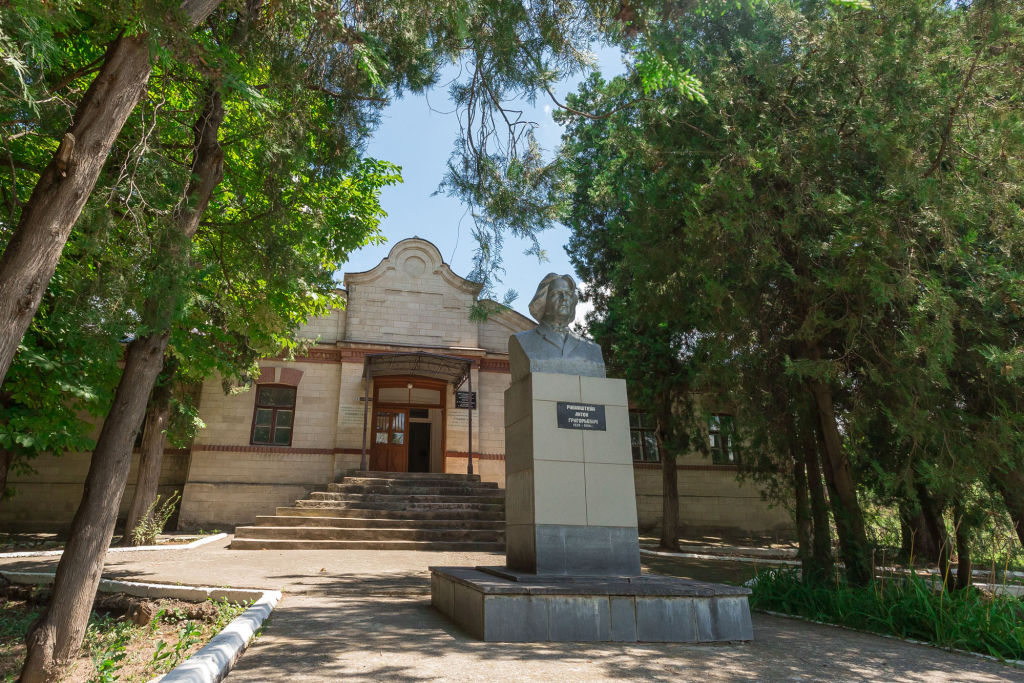
Museum of Anton Rubinstein and the History of Vykhvatintsy Village
The Museum of Anton Rubinstein opened on November 26, 1994, housed in a building constructed in 1901, dedicated to A.G. Rubinstein — the famous Russian pianist, conductor and composer who was born in Vykhvatintsy village. This museum brings together both the celebrated musician’s personal legacy and the broader history of the village that produced him.
The first exhibition hall presents an original portrait of A.G. Rubinstein, alongside Anton Grigorievich’s personal belongings, books containing opera scores and additional exhibits generously donated to the museum from the collections of the Leningrad Conservatory Museum, creating a comprehensive picture of Rubinstein’s musical career and personal life.
The second hall shifts focus to present materials documenting the broader history of Vykhvatintsy village itself. Remarkably, archaeologists working in this area discovered one of the first known sites of primitive human habitation in all of Eastern Europe, with evidence suggesting people lived here approximately 300,000 years ago. The site also includes a burial monument from the late Tripillya culture, dating back to the 3rd millennium BC — making Vykhvatintsy a location of genuine archaeological significance extending far beyond its connection to Rubinstein.
The third hall turns to more recent history, telling the stories of village inhabitants, participants in the Great Patriotic War, and defenders of the Pridnestrovian Moldavian Republic, connecting this ancient settlement’s deep past to its more contemporary historical experiences.
In front of the museum building stands a monument to Anton Grigorievich Rubinstein, erected in the late 1970s and created by sculptor R.E. Derbentsov. The bronze bust rests upon a tall rectangular pedestal standing 2.7 meters high, with the overall monument composition incorporating a wide staircase that leads visitors toward the main entrance of the museum building.
In the neighboring building stands the district children’s art school named after A.G. Rubinstein, which opened on September 1, 1973, making it one of the oldest educational institutions in the entire Rybnitsa district. The initiative to establish this school came from Moldovan composer Z.L. Carpenter, working alongside S.V. Segal, who served as head of the department of culture — together ensuring that Rubinstein’s musical legacy would continue inspiring future generations of young musicians from his native village.

Water Mill in the Village of Belochi
This old water mill stands on the Belochi River, sharing its name with both the village and the waterway that has powered it for generations. Built at the end of the 19th century, the mill has remarkably retained its original appearance throughout the decades, offering visitors an authentic glimpse into traditional milling architecture and engineering.
The mill’s construction showcases genuinely impressive craftsmanship: the entire building was assembled without using a single nail, with all the stones perfectly matched to fit together seamlessly. The wooden floors have successfully held the entire structure together for more than 125 years, a remarkable testament to the skill of the original builders. The mill’s equipment and mechanisms were imported directly from Zurich, reflecting the same pattern seen in other water mills throughout the region during this period, when European engineering expertise was sought to ensure the highest quality milling operations.

Tower of the Winds
Perched dramatically atop a steep rock overlooking Stroentsy, the Tower of the Winds stands as a striking 19th-century architectural monument and one of the most recognizable landmarks in the village. Built in the late 1800s, the tower was raised in memory of Peter Christianovich Wittgenstein — the celebrated Russian military commander and hero of the Patriotic War of 1812, whose legacy shaped the very landscape of this corner of the Dniester valley.
Before the 1917 revolution, the tower’s interior housed a bronze bust of the commander himself, while four cast-iron plates adorned its sides, each inscribed with heartfelt epitaphs honoring Wittgenstein’s memory. One of these moving inscriptions reads:
“Dear father! You have given the foundation for everything here, accept the due recompense for all time.”
Though the bust and some original details have not survived to the present day, the tower itself continues to stand as a powerful symbol of gratitude and remembrance — a tribute carved in stone to a man whose vision and investment transformed Stroentsy into the picturesque village it remains today.
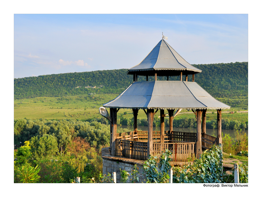
The Countess's Gazebo
Perched on the edge of the slope crowned by the Tower of the Winds, right alongside the famous grape terraces, the Countess’s Gazebo offers one of the most romantic vantage points in all of Stroentsy. This elegant structure was built in 1908 at the order of Maria Petrovna Zinovieva, granddaughter of the legendary Field Marshal Peter Christianovich Wittgenstein — a continuation of her family’s deep connection to this picturesque corner of the Dniester valley.
From the gazebo, visitors are treated to sweeping, scenic views stretching across the Dniester River, the village of Stroentsy below and the rolling countryside beyond. It remains one of the most beloved spots in the village for quiet reflection — a place where the beauty of the landscape and the echoes of aristocratic history come together in perfect harmony.

Grape Terraces
The grape terraces of Stroentsy form one of the most significant chapters in the village’s rich history, dating back to the early 19th century when Stroentsy belonged to the estate of Prince Peter Christianovich Wittgenstein. A passionate advocate of viticulture, Wittgenstein cleverly worked with the natural terrain, constructing stone terraces along the eastern slope to create the ideal conditions for cultivating his vines.
On these carefully engineered terraces, he grew both table and technical European grape varieties, even bringing in specialists from Germany to oversee their cultivation and ensure the highest quality. The terraces’ eastern-facing position proved to be a stroke of genius — receiving uninterrupted sunlight from dawn until dusk, this orientation allowed the grapes to ripen beautifully, producing fruit of exceptional quality.
The wines that emerged from these slopes earned a remarkable reputation, regarded as among the finest for preventing and treating gastric ailments — a testament to both the quality of the grapes and the skill of those who tended them. Today, the grape terraces of Stroentsy stand as one of the village’s most treasured historical monuments, a living legacy of Wittgenstein’s vision and the enduring connection between this land and the art of winemaking.
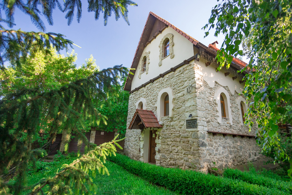
Water Mill
The story of Stroentsy’s iconic water mill begins in 1881, when the construction of the Slobodka–Rybnitsa railway dramatically expanded opportunities for importing machinery from Europe. Seizing on this new connectivity, Transylvanian architect and innovator Georgy Panteleevich Mazgan designed and built a water mill in the village, equipping it with mechanisms imported all the way from Zurich, Switzerland — a remarkable feat of engineering ambition for its time and place.
The mill underwent restoration in 1982, after which the building served for a time as a museum of bread. More recently, this 19th-century structure has been lovingly restored once again, this time at the expense of M.V. Orlov, ensuring its preservation for future generations.
Today, the water mill stands as one of the most beloved attractions not only in Stroentsy but across the entire northern region of Pridnestrovie. The picturesque natural surroundings blend seamlessly with thoughtful landscape design throughout the grounds, creating a setting of genuine charm. Within its historic walls, visitors will now find both a museum dedicated to the mill’s history and the restaurant and hotel complex “Old Mill” — allowing guests to dine, stay and explore all within this remarkable piece of living heritage.

Church of St. Michael the Archangel, Stroentsy Village
The story of the Church of St. Michael the Archangel in Stroentsy begins with the original wooden church, first established in 1702. This early structure was destroyed in the 1820s, and the land was subsequently used to build a palace for Prince Trubetskoy, which itself eventually collapsed in 1918, marking another chapter in this site’s layered architectural history.
Construction of the present church began in 1829, funded by Peter Christianovich Wittgenstein, whose patronage shaped so much of Stroentsy’s development during this period. A particularly distinctive feature of this temple lies in its architecture, which thoughtfully blends Orthodox and Lutheran traditions — the stone bell tower, topped with a distinctive spoke-shaped peak, bears a clear resemblance to German church design, creating a fascinating cross-cultural architectural statement that reflects the diverse influences present in this corner of the Dniester valley.
The church’s role in the community extended beyond purely religious functions: a school was established on its grounds in 1861, embedding the temple within the educational life of the village as well as its spiritual life. In the 20th century, to mark the 40th anniversary of Victory over Nazi Germany in the Great Patriotic War, a military history museum was opened here, named after P.A. Rumyantsev-Zadunaisky, adding yet another dimension to this multifaceted site. Finally, in the 1990s, the church underwent restoration and resumed functioning according to its original sacred purpose, completing a journey that saw this remarkable building serve religious, residential, educational and museum functions across more than three centuries.
For more information, visitors may contact Hegumen Sergiy (Vakhtomin).

Grotto of Ustym Karmaliuk
This remarkable grotto, carved directly into a stone slab in 1830, is popularly known among locals as “Karmaliuk’s Hut.” Inside, visitors will discover a small stove tucked into one corner of the room, stone benches lining the walls, and a modest little window providing natural light to this atmospheric space.
According to local legend, the grotto served as a hiding place for Ustym Karmaliuk — often called the “Ukrainian Robin Hood” — who led an anti-serf revolt across the right bank of Ukraine during the first half of the 19th century. This was no minor uprising: more than 20,000 peasants participated in the rebel movement under Karmaliuk’s leadership, making it one of the more significant peasant resistance movements of the era. For many years, Karmaliuk’s units conducted raids on manor houses throughout the region, redistributing the money and valuables seized during these operations to impoverished peasants — earning Karmaliuk his enduring reputation as a champion of the rural poor against an oppressive feudal system.

Church of Saint Paraskeva of the Balkans, Valia-Adynka Village
Tucked away in the northern reaches of Pridnestrovie, within one of the region’s most authentically preserved villages, stands a truly special and distinctive church, framed beautifully by rolling hills and a picturesque forest backdrop. This church sets itself apart through its unique architectural approach and refreshing simplicity of execution — a design philosophy that prioritizes harmony with the natural surroundings over elaborate ornamentation.
The temple’s walls are lined with natural stone, lending the building a grounded, earthy character that connects it directly to the landscape from which its materials were drawn. Adding a striking visual touch, both the bell tower’s roof and the central dome have been painted a vivid blue, creating a beautiful sense of unity between the church and the sky above, as well as the natural surroundings that frame this remarkable place of worship. The overall effect is a church that feels less like an imposition upon the landscape and more like an organic extension of it — a fitting spiritual home within one of Pridnestrovie’s most picturesque rural settings.

Grape Terraces
Following the Patriotic War of 1812, Prince P.Ch. Wittgenstein, accompanied by his wife, journeyed to southern Russia, where in 1805 he acquired the town of Kamenka for a substantial sum of 135,000 rubles. Recognizing the favorable climatic conditions of this region, the Prince made the strategic decision to invest in developing the local wine industry, taking full advantage of the area’s natural advantages for viticulture.
The first vineyards were carefully planted on a well-heated southern slope, arranged in terraces supported by thick stone walls that held the cultivated land in place. Construction of these terraces continued from the 1820s through to the end of the 1880s, ultimately spanning an impressive total length of 4.5 kilometers — a remarkable feat of agricultural engineering that transformed this hillside into productive vineyard land.
The grapes harvested from these terraces were processed at a dedicated winery, housed in a substantial stone building measuring 36 by 12 meters. Along its facade, the building features an elegant gallery supported by eighteen Doric columns, lending the structure considerable architectural distinction. Below ground, cellars reaching a depth of 6 meters were constructed in 1872, comprising six enfilades with cylindrical vaults built from large stone blocks, occupying the majority of the underground space. Each individual section within these cellars measures 6.5 meters in width, creating an impressive subterranean network designed specifically for the proper aging and storage of the wines produced from Wittgenstein’s ambitious viticultural venture.
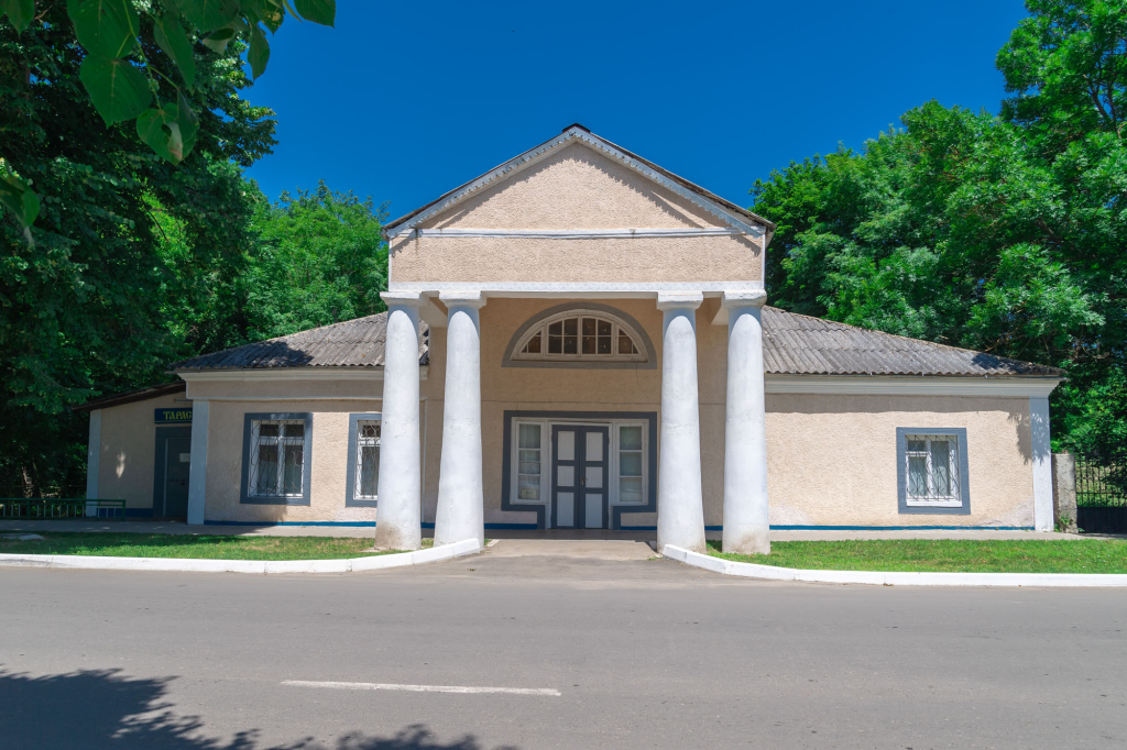
House of Princess Trubetskaya
The House of Princess Trubetskaya was constructed during the first half of the 19th century by P.Ch. Wittgenstein, the owner of Kamenka, specifically for his daughter Emilia. This elegant residence forms part of the vast estate and park complex that Wittgenstein developed throughout his ownership of this territory, reflecting the considerable wealth and aristocratic ambition that characterized his presence in this corner of the Dniester valley.
The house was designed in the architectural classicism style, a design approach that dominated estate construction throughout the Russian Empire during this particular period. This stylistic choice connects the Trubetskoy house to a broader tradition of aristocratic residential architecture that flourished across imperial Russia.
Today, the building has found new purpose, having been given over to the district community of Ukrainian culture, ensuring that this historic aristocratic residence continues serving an important cultural function for the local community, even as its original purpose as a princess’s private residence has long since passed.

Park Petra Wittgensteina
Map coords: 48.03289320783785, 28.686203956604004
Route title: Park Petra Wittgensteina
Route category: Parks
Route text:
This park, spanning 25 acres (approximately 27 hectares), was founded at the estate of Prince P.Ch. Wittgenstein during the 1820s, originally intended to serve vacationers seeking therapeutic treatment through grape juice consumption — a popular health practice of the era. The park’s design incorporated valuable tree species brought from abroad, while ponds were dug throughout the grounds and stocked with fish for raising. Additional decorative elements included numerous flower beds, one of which was specifically designed to depict the Wittgenstein family coat of arms, adding a personal heraldic touch to the landscape.
The park’s purpose shifted significantly during the 1960s, when buildings belonging to an agricultural technical school occupied portions of the grounds. Subsequently, the park underwent reconstruction, transforming it into a popular recreation area, and in 2018, it received its current name: Park Petra Wittgensteina, formally honoring the prince whose vision originally created this green space.
The amphitheater-like ridge, upon which the famous grape terraces are situated, serves as a picturesque natural backdrop for the park’s landscape. Today, more than a hundred species of trees and shrubs flourish throughout the grounds, including Japanese chestnut, juniper, white poplar, sharp-leaved maple and ash, creating remarkable botanical diversity. The park also features a stage used for hosting various cultural events throughout the year.
In 2011, a bust of the prince was installed within the park, though it was subsequently relocated to the Glory Memorial — a monument dedicated to soldiers who died during the Great Patriotic War. At this new location, a comprehensive historical and cultural complex was created around the bust, with one of the granite slabs installed there providing detailed information about the life of P.Ch. Wittgenstein and his significant contributions to the development of Kamenka, ensuring his legacy remains connected to the town he helped shape, even as the physical location of his memorial has changed over time.
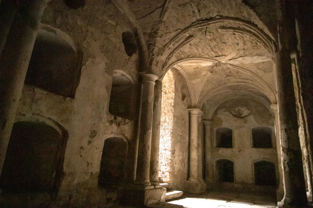
The Crypt of the Family of P.Kh. Wittgenstein
The family vault of the outstanding Russian commander and Hero of the Patriotic War of 1812, Prince P.Ch. Wittgenstein, was constructed in 1840 near the Lutheran Church. The vault’s interior featured niches designed specifically for burying the deceased, each elaborately decorated with columns and topped with a vaulted ceiling, creating a dignified resting place befitting the prince’s distinguished family.
Historical records confirm that Peter Christianovich himself, along with his wife Antonina Stanislavovna, daughter Emilia Petrovna Trubetskaya and other family members, were all buried within this vault. Additionally, the crypt held a silver vessel containing the heart of P.Ch. Wittgenstein’s son, Lev Petrovich, who had died in Germany — a poignant detail reflecting the period’s particular funerary customs for those who died far from their family’s ancestral resting place. The coffins containing the deceased were stored within niches that had been walled with marble slabs, each bearing inscriptions noting the surname, given name, patronymic, and dates of birth and death of the person interred there.
Unfortunately, the vault’s history took a tragic turn during the Soviet era: in 1934, the church was closed, and a few years later, the family vault itself was desecrated. Today, only a single plate marking the grave of A.S. Wittgenstein (Snarska) has survived this destruction. The current whereabouts and final resting place of the other Wittgenstein family members buried here remain unknown, representing a significant loss of historical and genealogical continuity for this once-prominent aristocratic family connected so closely to Kamenka’s development.

Church of the Archangel Michael, Village Khrustovaya
The history of the Church of the Archangel Michael in Khrustovaya village spans nearly three centuries, though the current building — a striking one-domed structure in the Byzantine style — was completed by 1853. Originally, the temple stood atop a mountain, dramatically surrounded by massive blocks of sandstone, towering impressively over the entire village below.
Like so many religious buildings throughout the region, the church suffered closure during the Soviet era. For a considerable period, the building served as a village club, before later being repurposed as a warehouse for pesticides — a stark departure from its original sacred purpose. Restoration efforts finally began in 1991, marking a turning point in the building’s fortunes; the church was consecrated that same year in honor of the Archangel Michael, beginning a gradual process of revival that would unfold over the following decades.
Step by step, the roof, domes and iconostasis were carefully installed, beautiful painting gradually appeared throughout the temple’s interior, and additional structures including cells, a refectory and dining rooms were constructed to support the growing religious community. The restoration reached a significant milestone in 2011-2012, when a substantial bell tower, standing 37 meters high and crowned with a cross, was erected beside the temple — ultimately housing 10 bells that now ring out across the village, completing this remarkable three-decade journey from abandonment back to full spiritual life.
For more information, visitors may contact Archpriest Eugene Kamenshchik.