
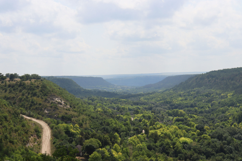
Ecological trails of the north of Pridnestrovie
Ecological Trails of the North
Discover one of the most ambitious and flexible hiking networks in all of Pridnestrovie — the Ecological Trails of the North — a 129 km web of paths connecting the villages of Valya-Adynka, Konstantinovka, Rashkov, Sadki, Katerinovka, Belochi and Stroentsy across the Kamenka and Rybnitsa districts. With 31 remarkable stops spanning natural cliffs, ancient cemeteries, rural markets, museums and centuries-old churches, this route can be walked in full or broken into manageable segments — started from any point along the way, according to your own pace and interests.
Forest paths lead to dramatic cliff-top observation points with sweeping views across the Dniester and its gorges. Along the way, village after village reveals rural architecture that has barely changed in generations, alongside preserved historical monuments, rest areas, local markets, shops, first aid stations and natural water sources — everything needed for a genuinely self-sufficient walking adventure.
🏡 Accommodation along the route: Cossack Guest House (Valya-Adynka) | Sadki Country House (Sadki village) | Chalet and Restaurant-Hotel Complex “Old Mill” (Stroentsy) | Tourist Complex “Dubrava” (Belochi)
🥬 Local agricultural markets: Valya-Adynka (Tuesdays 09:00–10:00) | Konstantinovka (Tuesdays 08:00–09:00) | Rashkov (Tuesdays 07:00–10:00) | Stroentsy (Thursdays 08:00–09:30) | Belochi (Fridays 08:00–09:00) | Katerinovka (Saturdays 07:00–09:00)
Valya-Adynka: Outlaw Legends and a Cossack Welcome
The network opens in Valya-Adynka village with the legendary Grotto of Ustym Karmaliuk (Kamenka district) — a cave cut through solid rock associated with the celebrated Ukrainian outlaw and folk hero whose spirit of resistance still seems to echo through the stone.
Just 1.3 km away, the Stone Head — an uncanny natural rock formation resembling a human face — adds a touch of geological mystery to the trail.
After 1.6 km, the Church of Saint Paraskeva of the Balkans (37 Zarechnaya Str., Valya-Adynka village) offers a moment of spiritual stillness, while just 1.1 km further, the Cossack Guest House (81 Mira Str., Valya-Adynka village) provides warm accommodation for those wishing to overnight here.
The Landscape Reserve “Valya-Adynka” (100 meters away) rounds off this section with a protected natural area of genuine ecological significance — forest, cliff and meadow habitats preserved in their natural state.
Konstantinovka: A Pilot’s Grave and a Garden Nursery
After 5.7 km, the trail reaches Konstantinovka village and the Grave of Pilot S.I. Kharkhalup (Central Str., Kamenka district) — a solemn memorial to a fallen aviator whose story adds a layer of 20th-century heroism to the walking route.
Just 970 meters away, the Kamenka Nursery offers a delightful and unexpected change of pace — a living green space of cultivated plants and flowers perfect for a relaxed browse between more demanding sections of the trail.
Rashkov: Layers of History in the Oldest Village on the Trail
After 10 km, the network arrives at its most historically dense stretch — Rashkov village, one of the oldest settlements in Pridnestrovie, documented since 1402.
The Rashkov Natural Complex (900 meters in) opens the village section with a striking natural landscape, followed 1.7 km later by the Observation Deck in Rashkov — one of the finest viewpoints on the entire network, offering panoramic vistas across the Dniester valley below.
Just 260 meters away, Panska Krynitsa delivers fresh spring water steeped in local legend, while 420 meters further, the haunting Ruins of the Synagogue (Bazarnaya Str.) bear witness to the once-thriving Jewish community that shaped this village for centuries.
After 940 meters, the St. Cajetan Catholic Church continues Rashkov’s remarkable interfaith story, and just 9.2 meters away — practically next door — the Jewish Cemetery and, 710 meters further, Rabbi Shabtai’s Grave (Rashkov village, Kamenka district) add deeply significant layers of Jewish heritage to the walk.
After 330 meters, the Museum of Hero of the Soviet Union F.I. Zharchinsky (35 Fiodora Zharchinskogo Str.) honors one of Rashkov’s most celebrated sons, and the village section concludes 6.6 km later at the atmospheric Ruins of the Intercession Church (Pokrovskaya Str.) — a hauntingly beautiful remnant of a once-active parish.
Katerinovka: Faith and Lakeside Rest
After 140 meters, the trail reaches Katerinovka village and the Church of the Ascension of the Lord (Gorky Str., Kamenka district) — a peaceful rural church that sets a contemplative tone.
Just 12 km away, the Recreation Area on the Lakeside in Katerinovka village offers a welcome opportunity to rest, swim or simply enjoy the water before continuing onward.
Sadki: A Countryside Pause
After 21 km, the Sadki Country House (9 Dachnaya Str., Sadki village, Kamenka district) provides a comfortable rural waypoint — ideal for those breaking the full network into multi-day segments and needing a peaceful overnight stop between the Kamenka and Rybnitsa sections of the trail.
Stroentsy: The Aristocratic Heart of the Network
After 11 km, the trail enters Stroentsy village — the single richest concentration of stops on the entire network, shaped by the legacy of Field Marshal Peter Wittgenstein.
The Kalagur Area opens this extensive section with dramatic natural scenery, followed closely by the Ruins of the Yurevich Palace, the rocky outcrop of Svinerest (a popular rock-climbing destination) and the dedicated Climbing Trail in the Kalagur Area — together forming one of the most adventurous stretches of the entire network.
Just 9.1 km further, the Monastery of John the Precursor (Kalagur area, Stroentsy village) offers profound spiritual tranquility among the cliffs, while the iconic Tower of the Winds marks the heart of the village proper.
The sweeping Grape Terraces (1.8 km away) and the romantic Countess’s Gazebo (3.5 km further) showcase the aristocratic landscape vision of the Wittgenstein estate, while the charming Water Mill (920 meters away) and the “Teplitsa” Springs System (3.5 km further) add rural heritage and refreshing natural spring water to the walk.
The Museum of P.A. Rumyantsev-Zadunaisky and the History of Stroentsy Village (86 P.A. Rumyantsev-Zadunaisky Str.) honors another illustrious historical figure connected to this remarkable village, and the Stroentsy section concludes at the Church of St. Michael the Archangel (Polevaya Str.) — a parish church dating to 1829 that brings this extraordinarily rich village walk to its spiritual conclusion.
With museums, monuments, markets, guesthouses and natural water sources distributed conveniently along its full 129 km length, the Ecological Trails of the North network rewards both the ambitious through-hiker and the casual day walker in equal measure — every village a destination in its own right, every segment a complete and satisfying journey through the natural and cultural heritage of northern Pridnestrovie.

Grotto of Ustym Karmaliuk
This remarkable grotto, carved directly into a stone slab in 1830, is popularly known among locals as “Karmaliuk’s Hut.” Inside, visitors will discover a small stove tucked into one corner of the room, stone benches lining the walls, and a modest little window providing natural light to this atmospheric space.
According to local legend, the grotto served as a hiding place for Ustym Karmaliuk — often called the “Ukrainian Robin Hood” — who led an anti-serf revolt across the right bank of Ukraine during the first half of the 19th century. This was no minor uprising: more than 20,000 peasants participated in the rebel movement under Karmaliuk’s leadership, making it one of the more significant peasant resistance movements of the era. For many years, Karmaliuk’s units conducted raids on manor houses throughout the region, redistributing the money and valuables seized during these operations to impoverished peasants — earning Karmaliuk his enduring reputation as a champion of the rural poor against an oppressive feudal system.
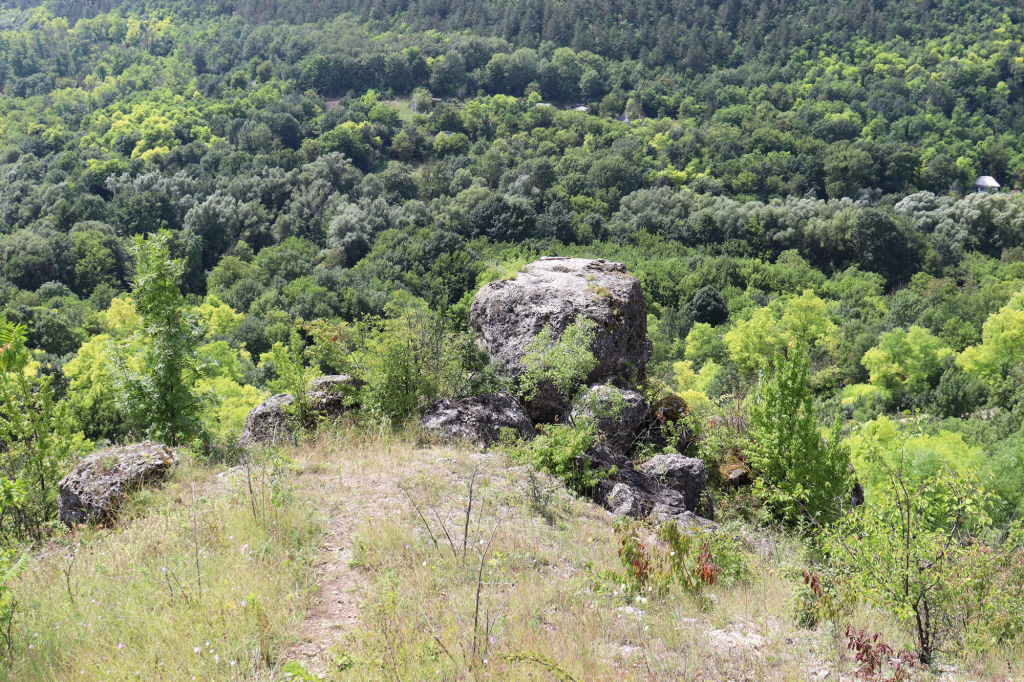
Stone Head
The Stone Head represents one of the most unusual and visually striking natural rock formations found in Valya-Adynka village, distinguished by its remarkable resemblance to the shape of a human head — an uncanny natural sculpture created through countless years of geological processes and erosion.
From the very top of this distinctive formation, visitors are rewarded with a splendid panoramic view stretching across the Golden River valley, offering one of the most memorable vistas in the entire surrounding landscape. Beneath the stone formation itself, visitors can discover what resembles an ancient grotto, adding an element of mysterious exploration to this already fascinating natural curiosity. The combination of the formation’s unusual appearance, the underground grotto-like space beneath it, and the spectacular valley views from its summit make the Stone Head a genuinely captivating destination for those exploring the natural wonders of the Kamenka district.

Church of Saint Paraskeva of the Balkans, Valia-Adynka Village
Tucked away in the northern reaches of Pridnestrovie, within one of the region’s most authentically preserved villages, stands a truly special and distinctive church, framed beautifully by rolling hills and a picturesque forest backdrop. This church sets itself apart through its unique architectural approach and refreshing simplicity of execution — a design philosophy that prioritizes harmony with the natural surroundings over elaborate ornamentation.
The temple’s walls are lined with natural stone, lending the building a grounded, earthy character that connects it directly to the landscape from which its materials were drawn. Adding a striking visual touch, both the bell tower’s roof and the central dome have been painted a vivid blue, creating a beautiful sense of unity between the church and the sky above, as well as the natural surroundings that frame this remarkable place of worship. The overall effect is a church that feels less like an imposition upon the landscape and more like an organic extension of it — a fitting spiritual home within one of Pridnestrovie’s most picturesque rural settings.
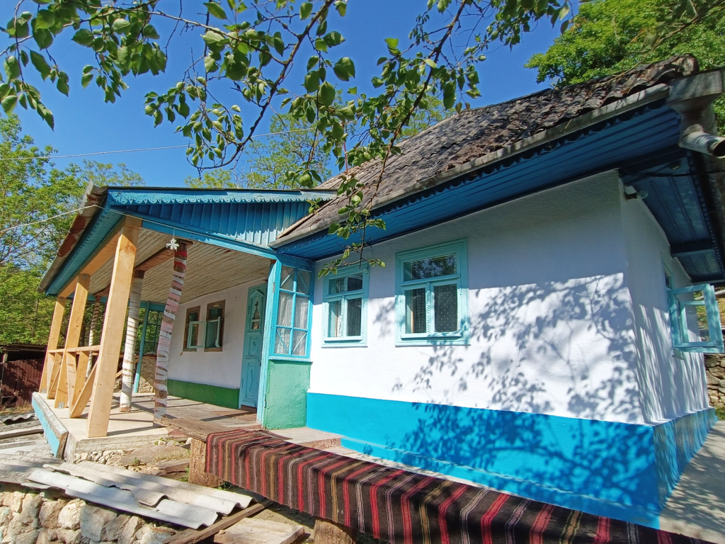
Cossack Guest House
The Cossack Guest House promises calm and peaceful rural living, with fresh, clear air, genuine silence and organic homemade products combining to guarantee guests the most pleasant possible impressions from their countryside getaway. The establishment’s cozy atmosphere, paired with its close proximity to nature, creates an ideal environment for relaxation and genuine disconnection from urban life.
A uniquely authentic stylistic approach throughout the guest house transports visitors back through time, allowing them to touch history directly while becoming acquainted with the local traditions, daily life and cuisine that have characterized this region’s Cossack heritage for generations. The guest house welcomes overnight tourists specifically during the warmer months, operating from April through October, ensuring guests can fully enjoy the surrounding natural beauty and outdoor activities that this seasonal window of operation makes possible.
Landscape Reserve "Valya-Adynka"
The Valya-Adynka landscape reserve is situated within Kamenka district, encompassing a substantial area of 290 hectares dedicated to preserving this distinctive natural environment. The name “Valya Adynka” translates from Moldovan as “deep valley,” an apt description of the dramatic landscape feature at the heart of this protected area.
This picturesque valley cuts dramatically through powerful limestone strata characteristic of the broader Podolsk Upland, creating steep slopes that host an established oak forest along their surfaces. The Zolotaya River flows through the valley floor, providing the water source that has shaped this landscape over countless centuries. Near the springs found in the lower portions of the slope, rare plant species thrive, taking advantage of the unique microclimate created by this combination of geological and hydrological features.
This reserve offers visitors a genuinely atmospheric experience — functioning almost like a time machine that transports modern visitors back to ancient times. It comes as little surprise that humans chose to settle in this valley during the era of fire and stone, drawn by the same natural resources and dramatic landscape beauty that continue to captivate visitors exploring this protected corner of northern Pridnestrovie today.

Grave of the Pilot S.I. Kharkhalup, Konstantinovka Village
Senior Lieutenant Semyon Ivanovich Kharkhalup demonstrated extraordinary aerial combat skill during the early days of the Great Patriotic War, completing 52 air battles and successfully destroying three enemy aircraft during this intense period of fighting. In one particularly daring engagement, he made the courageous decision to ram a German bomber aircraft, demonstrating remarkable bravery in defense of his homeland.
Tragically, on the morning of June 30, 1941, Semyon Ivanovich died during an unequal battle against enemy fighters. His plane crashed on the outskirts of his native village, witnessed directly by villagers who watched the battle unfold overhead — including, devastatingly, his own parents among those present to see this final, fatal engagement.
Following the war’s conclusion, the remains of S.I. Kharkhalup were reburied in the center of Konstantinovka, where a monument was subsequently installed taking the distinctive form of a MiG-15 tail section, bearing the moving inscription: “Those who lost their lives in the sky over the Motherland become the sky above it.” Additionally, a smaller memorial obelisk was erected at the actual site of the pilot’s death, ensuring that both his final resting place and the location where he made his ultimate sacrifice remain permanently marked and honored within the village he gave his life defending.
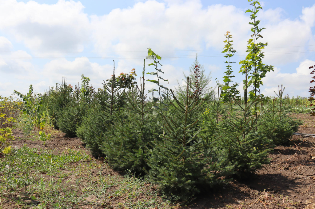
Kamenka Nursery
This nursery operates as the largest farm of its kind anywhere in Pridnestrovie, specializing in cultivating seedlings, fruit trees, roses and a wide variety of shrubs, deciduous, decorative and coniferous plants. Founded in 1990, the nursery is located in Konstantinovka village within Kamenka district, having grown substantially since its establishment more than three decades ago.
Today, the nursery’s total area spans approximately 30 hectares, supporting the cultivation of thousands of garden plants across this extensive growing operation. Visitors can purchase plants directly for their own gardens, while during the warm season, the nursery also offers opportunities to participate in harvesting fruits and berries grown on-site — providing a genuinely hands-on agricultural experience for interested visitors.
The nursery additionally features a picnic area available for use by prior arrangement, allowing visitors to combine their plant shopping or harvesting activities with a relaxing outdoor meal amid this productive and beautifully maintained agricultural landscape.
Route aderes: Konstantinovka village, Kamenka district
Natural Complex
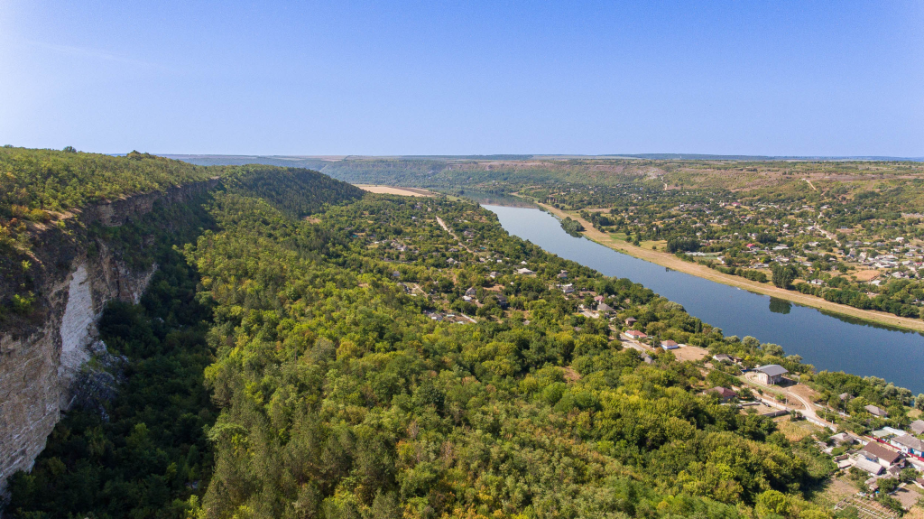
The natural complex surrounding Rashkov village encompasses an impressive 123 hectares, incorporating the western land tracts where Chervona (Red) Rock displays abundant karst deposits. Over countless centuries, shell rock formations here gradually developed into a powerful wall, with numerous karst voids creating a texture resembling a porous sponge throughout this remarkable geological structure. One side of this wall features a dramatic cliff face, rising to an approximate height of 50 meters.
Visitors to this natural complex will be delighted by the beautiful interplay of sunlight against karst grains of sand, while also discovering an extraordinary karst fault — measuring just 5 meters in width, yet plunging to depths of 50 meters and extending 500 meters in length. The bottom of this dramatic fault remains remarkably cold throughout the year, with snow persisting in this sheltered space almost continuously regardless of season.
The Rashkov complex offers numerous additional attractions beyond these geological wonders, including the celebrated Panska Krynitsa spring. This source draws its name from a beautiful ancient legend concerning the lovely Domnitsa Ruksanda and her husband Timush Khmelnitsky. Following her husband’s death, Ruksanda mourned him for an extended period within the Rashkov Tower, shedding tears so abundant that legend says they formed an entire spring. The water flowing from this source remains, fittingly, always exceptionally clean and cold — as if carrying forward the purity of that ancient sorrow into the present day.
Observation deck in the village of Rashkov
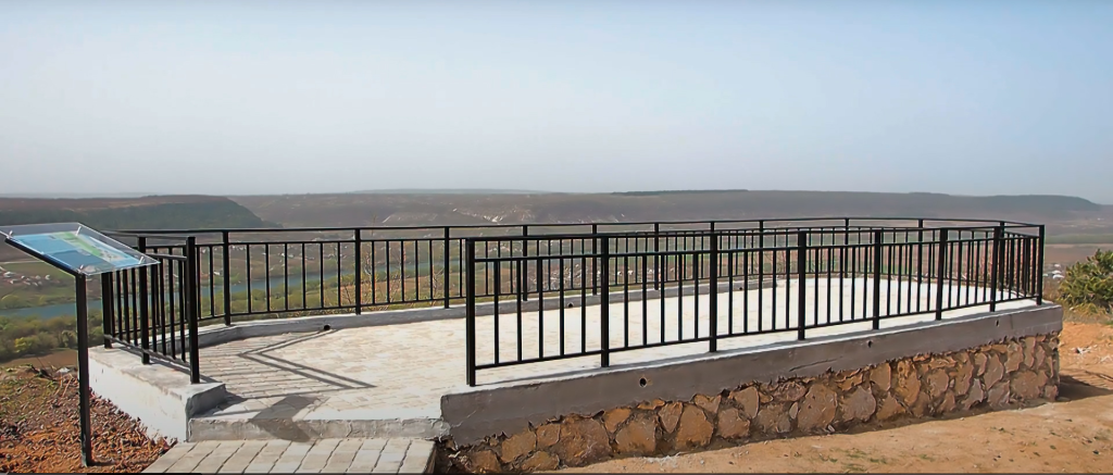
This observation deck, positioned within Rashkov village, offers visitors sweeping views encompassing the Dniester River, surrounding rocky formations and the village itself, providing one of the finest panoramic vantage points in this historically rich area.
At the site, visitors will find a helpful information board displaying the history of Rashkov alongside a map highlighting local attractions, allowing travelers to better orient themselves and plan their exploration of this remarkable multicultural village. The board additionally features a QR code that connects directly to the official travel website of Pridnestrovie, providing convenient digital access to further information and resources for those wishing to continue learning about the region beyond what’s displayed at this single observation point.

Panska Krynitsa
Tucked away near the ruins of the old Jewish synagogue, Panska Krynitsa — meaning “The Spring of the Mistress” — stands as a cultural heritage site dating back to the middle of the 17th century, its name carrying with it one of the most poignant love stories in the history of Rashkov.
The spring’s name is forever linked to Ruksanda, daughter of the Moldavian Principality’s Hospodar Vasily Lupu. In 1652, she married Timofey, son of the legendary Ukrainian Hetman Bogdan Khmelnytsky. Tragedy struck just a year later, when Timofey was fatally wounded during the siege of Suchava Fortress. In the aftermath of his son’s death, Bogdan Khmelnytsky gifted the village of Rashkov to the grieving Ruksanda, who would go on to live here for thirteen long years, carrying her sorrow with her.
According to local legend, the spring that came to bear her name — “Panska Krynitsa” — emerged from the very tears Ruksanda shed while mourning the untimely loss of her beloved husband, a story that has been passed down through generations and continues to give this natural spring its deeply romantic and melancholic significance.

Ruins of the Synagogue
Constructed around 1749 using funds collected through the so-called “basket tax” — a specialized form of taxation of the era — this synagogue once stood at the very heart of Rashkov’s spiritual and communal life. During this period, the village held particular significance as one of the centers of world Hasidism, a religious movement within Judaism that swept through the Jewish population of the Polish-Lithuanian Commonwealth and surrounding territories during the first half of the 18th century.
For generations, the synagogue served as the spiritual anchor for Rashkov’s substantial and vibrant Jewish community. Tragically, the building’s fate changed dramatically in the early 1930s, when the Soviet anti-religious campaign led to the destruction of its vaults. Today, only the stone walls and a handful of interior architectural elements remain standing from what was once a truly majestic structure — a haunting reminder of the rich Jewish heritage that once flourished in this corner of Pridnestrovie.
St. Cajetan Catholic Church
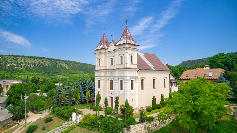
St. Cajetan Catholic Church holds a unique distinction as the oldest Catholic church in all of Pridnestrovie, remarkably preserved in nearly its original form to this day. The decision to build the church dates back to 1749, when Prince Jozef Lubomirski made the commitment to its construction — a decision documented in the historic manuscript known as the “Act of Foundation of the Church in Rashkovo.” Construction itself was completed in 1786, with the church consecrated five years later in honor of St. Cajetan.
Architecturally, the building stands as a classic example of 18th-century Polish Catholic church design, incorporating elegant Baroque elements that reflect the artistic sensibilities of its era. The church’s history took a difficult turn during the Soviet period, when it was closed by local authorities and repurposed first as a granary, then later as a joiner’s workshop — a fate shared by many religious buildings during that time.
It wasn’t until 1990 that the church was finally returned to the Catholic community. Since then, services have once again filled the building with the sounds of the pipe organ, restoring this remarkable piece of 18th-century heritage to its original sacred purpose.
Jewish Cemetery, Rashkov Village
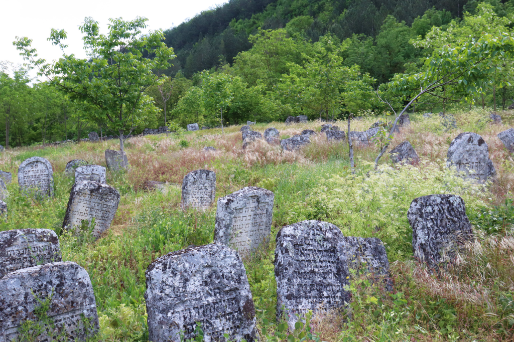
Jewish cemeteries in the Podolsk townships of this era typically followed a consistent pattern, located outside city limits along the lines where fortification ramparts had once stood during the 17th and 18th centuries. This particular cemetery in Rashkov village serves as a clear historical marker, precisely delineating the western border of the city as it existed at the beginning of the 18th century — with its oldest surviving gravestone dating back to 1709, providing a remarkably early window into the long history of Jewish settlement in this ancient village.
This cemetery thus offers more than simply a place of burial; it functions as a kind of historical document in stone, helping researchers and visitors alike understand not only the depth of Jewish presence in Rashkov but also the very physical boundaries and development of the village itself during this formative period of its history.
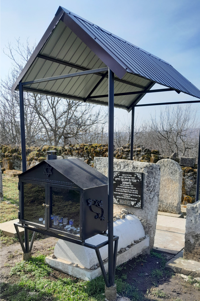
Rabbi Shabtai's Grave
A Jewish community has existed within Rashkov’s territory since ancient times, with the very first documented mention of Jews in this locality dating back to 1637. To this day, visitors can still find the original synagogue building alongside two distinct Jewish cemeteries, preserving tangible evidence of this long and significant religious presence.
Rashkov held particular importance as one of the centers of Hasidism — a mystical movement within Judaism — serving as the residence for Hasidic rabbis belonging to the Rashkov dynasty. At the beginning of the 18th century, Rabbi Shabtai established a Hasidic court here in Rashkov, where he also composed his celebrated prayer book in Hebrew, known as the Siddur — a significant religious text that connects this small village directly to important developments within the broader history of Hasidic Judaism, making Rashkov a meaningful site of pilgrimage for those interested in this particular spiritual tradition.

Museum of Hero of the Soviet Union F.I. Zharchinsky
Fyodor Ivanovich Zharchinsky joined the Red Army at the very outbreak of the Great Patriotic War, going on to participate in significant battles across Ukraine, the Caucasus and Eastern Europe throughout the course of the conflict. During the decisive Berlin operation on April 21, 1945, Senior Lieutenant Zharchinsky, alongside a group of reconnaissance scouts, discovered a concentration camp in the German town of Treuenbrietzen. Making the courageous decision to liberate the prisoners held there, the scouts engaged the camp’s guards in direct confrontation.
The operation proved extraordinarily successful, resulting in the liberation of 4,500 prisoners of war representing multiple nationalities — Russians, French, Poles, Danes, Belgians and Norwegians, including notably the commander of the Norwegian armed forces, Major General Otto Ruge. However, this victory came at tremendous personal cost: Zharchinsky, who had personally killed six guards along with the camp commandant during the engagement, was mortally wounded and died shortly afterward from his injuries. In recognition of this extraordinary act of heroism, he was posthumously awarded the title Hero of the Soviet Union.
On May 23, 1982, a museum dedicated to this outstanding son of Rashkov opened in the village, preserving his memory for future generations. In 2011, a bust honoring the hero was installed beside the school where he had once taught and which he led during the pre-war years — creating a permanent physical connection between Zharchinsky’s wartime heroism and the educational institution where he first served his community before the war that would ultimately claim his life.

Ruins of the Intercession Church
Built in 1740, the Intercession Church carries a fascinating religious history within its weathered walls — originally established as a Greek Catholic (Uniate) church before later transitioning to Orthodox worship, reflecting the shifting religious currents that shaped this region over the centuries.
Like so many other religious buildings across Pridnestrovie, the church suffered destruction during the Soviet years, falling victim to the era’s widespread anti-religious campaigns. Today, only the church’s walls and a portion of its original shingle roof have managed to survive, standing as a quiet and somewhat melancholic testament to a place of worship that once served the faithful of Rashkov for two centuries.
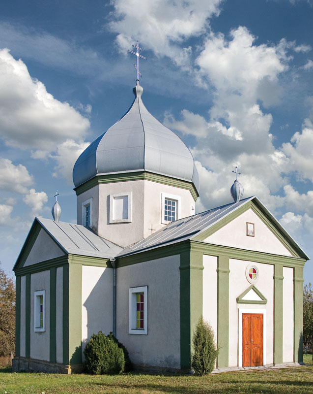
Church of the Ascension of the Lord, Village Katerinovka
The Church of the Ascension of the Lord in Katerinovka village owes its existence to the diligence and dedication of local landowner Major General Alexei Tutolmin, who oversaw its construction in 1825. The church’s history, however, has not been without interruption — nearly a century later, during the 1930s, the building was forced to close, reflecting the broader anti-religious campaigns of the Soviet era. It reopened in 1941, continuing to serve the local faithful until 1960, when its doors closed once more.
Today, this historic building holds official recognition as an architectural monument of republican significance, acknowledging both its aesthetic and historical value to the broader heritage of Pridnestrovie. For more information about the church, visitors may contact Priest Alexander Ryabov.
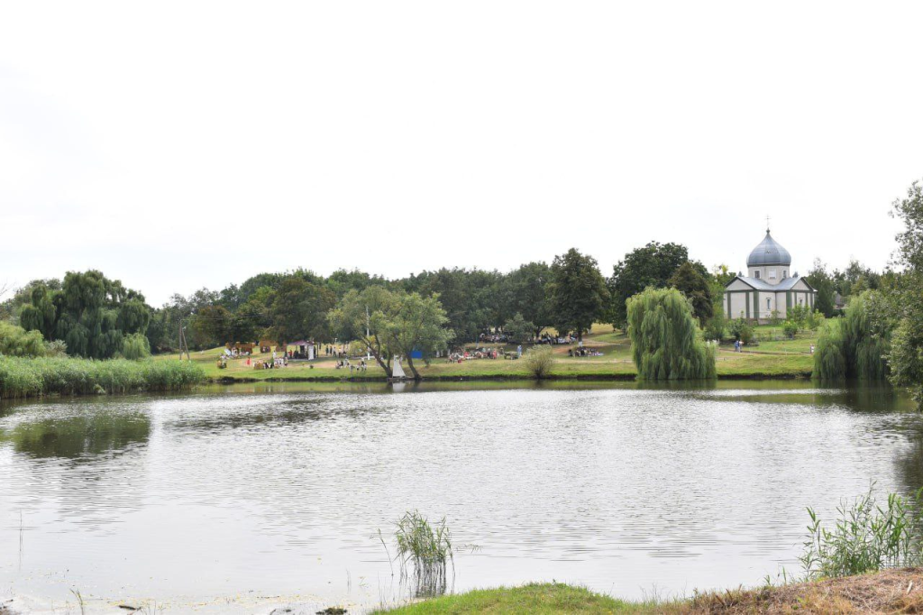
Recreation Area on the Lakeside in the Village of Katerinovka
This cozy recreation area enjoys a pleasant setting in the shade of surrounding trees, thoughtfully equipped with barbecue facilities for visitors wishing to enjoy outdoor cooking amid this tranquil lakeside environment. The recreation area offers convenient car access, making it an easy destination for families and groups planning a relaxing outing.
Adding to the site’s family-friendly appeal, a children’s playground stands right on the lake shore, providing entertainment for younger visitors while parents relax nearby. This combination of practical amenities and natural beauty makes the Katerinovka lakeside recreation area an excellent destination for a leisurely day trip, whether visitors are seeking a peaceful picnic spot or a place where the whole family can enjoy time together by the water.
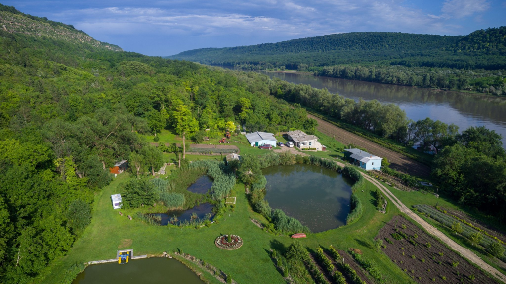
Sadki Country House
Sadki Country House encompasses approximately 4 hectares, situated in a genuinely picturesque location — bordered to the east by mountain and forest, while to the west the property meets the gentle bends of the Dniester River. The “Fazenda Sadki” offers cozy accommodation that can comfortably house up to 12 guests, with the house equipped with a toilet, shower room and a kitchen featuring everything necessary for guest meal preparation.
Sadki stands out as a remarkable agro-tourism destination in its own right. The working farm cultivates seedlings of forest and fruit and berry crops alongside various herbs, while also maintaining active beekeeping operations — bees here provide not only honey and other natural products but also play an important role in the recovery and wellness treatments offered to visitors and tourists.
Within the country house grounds, guests will find a dedicated bee-sting therapy house, where visitors can experience therapeutic sleeping positioned directly above active beehives. Beneath each bed rest two beehives, with approximately 25,000 bees housed in each, creating a unique apitherapy experience believed to offer various health benefits. Complementing this distinctive treatment, the property also offers a bath featuring a Japanese ofuro tub, with water specially infused with lavender, linden blossom and various other medicinal herbs combined with bee products. Throughout these therapeutic procedures, water temperature remains consistently maintained at 40°C through continuous heating, ensuring optimal therapeutic conditions.
The landscape design surrounding the country house proves particularly fascinating for visiting tourists, featuring two beautiful lakes, natural springs, picturesque flower beds and abundant green spaces — creating a comprehensive wellness retreat that combines genuine agricultural production with therapeutic treatment and simple aesthetic natural beauty.
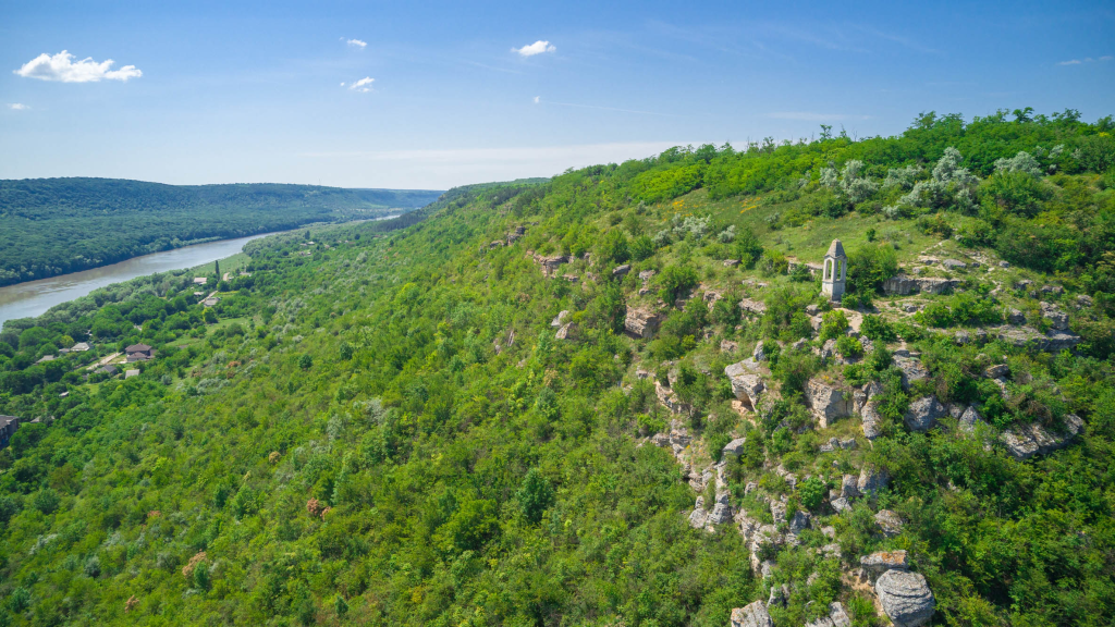
Kalagur Area
The Kalagur area, also known as Stroentsy Forest, is located within Rybnitsa district near Stroentsy village, representing one of the most picturesque locations found anywhere in Pridnestrovie. The area offers beautiful panoramic views overlooking the Dniester River valley, drawing visitors who appreciate dramatic natural landscapes combined with significant historical and cultural landmarks.
Geologically, this area once formed the very bottom of the ancient Sarmatian Sea, explaining why the mountain’s structure consists predominantly of shell rock — a composition that has shaped both the landscape’s distinctive appearance and its suitability for certain recreational activities. Rock climbing is actively practiced throughout these formations, drawing adventure-seeking visitors to test their skills against this ancient geological terrain.
The Kalagur area additionally hosts two significant cultural landmarks: the Monastery of John the Precursor, a spiritually significant religious site nestled among the cliffs and forest, alongside the evocative ruins of the Yuryevich Palace, adding historical depth to this already remarkable natural setting. Together, these elements combine natural beauty, geological interest, recreational opportunity and cultural heritage into a single compelling destination within the broader Stroentsy area.
Ruins of the Yurevich Palace
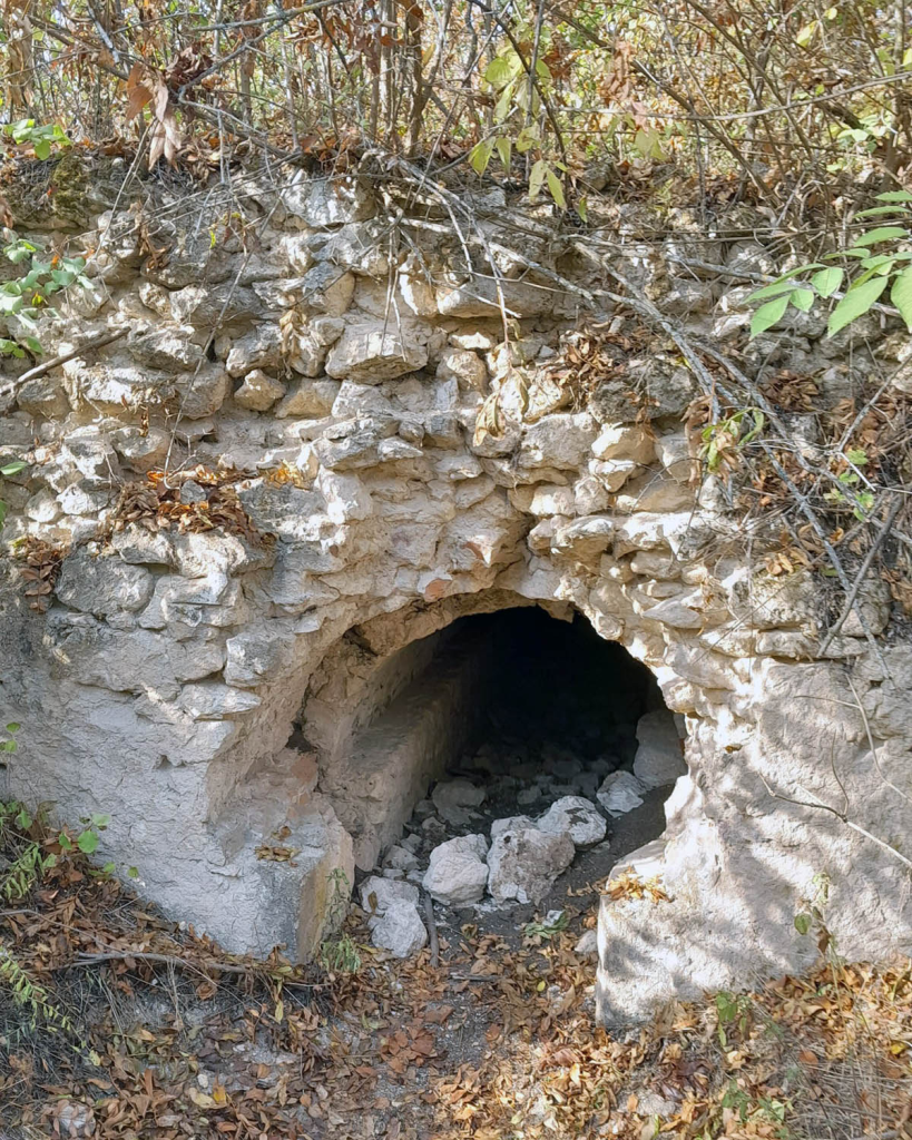
At the end of the 19th century, a magnificent mansion rose here, commissioned by Vadim Aleksandrovich Yurevich — an English tycoon of Russian origin who chose this picturesque corner of Stroentsy for his palatial residence. The palace grounds were elaborately equipped with decorative alleys and fountains, creating an aristocratic estate befitting Yurevich’s considerable wealth and status.
Unfortunately, around 1920, this once-grand mansion suffered destruction, with only a portion of the original foundation surviving to the present day. These remaining ruins now stand as a poignant reminder of the palace’s former glory, offering visitors a glimpse into the aristocratic estate culture that once flourished throughout this region before the upheavals of the early 20th century swept away so much of the elaborate architectural heritage that wealthy landowners had constructed throughout the Dniester valley.
Svinerest
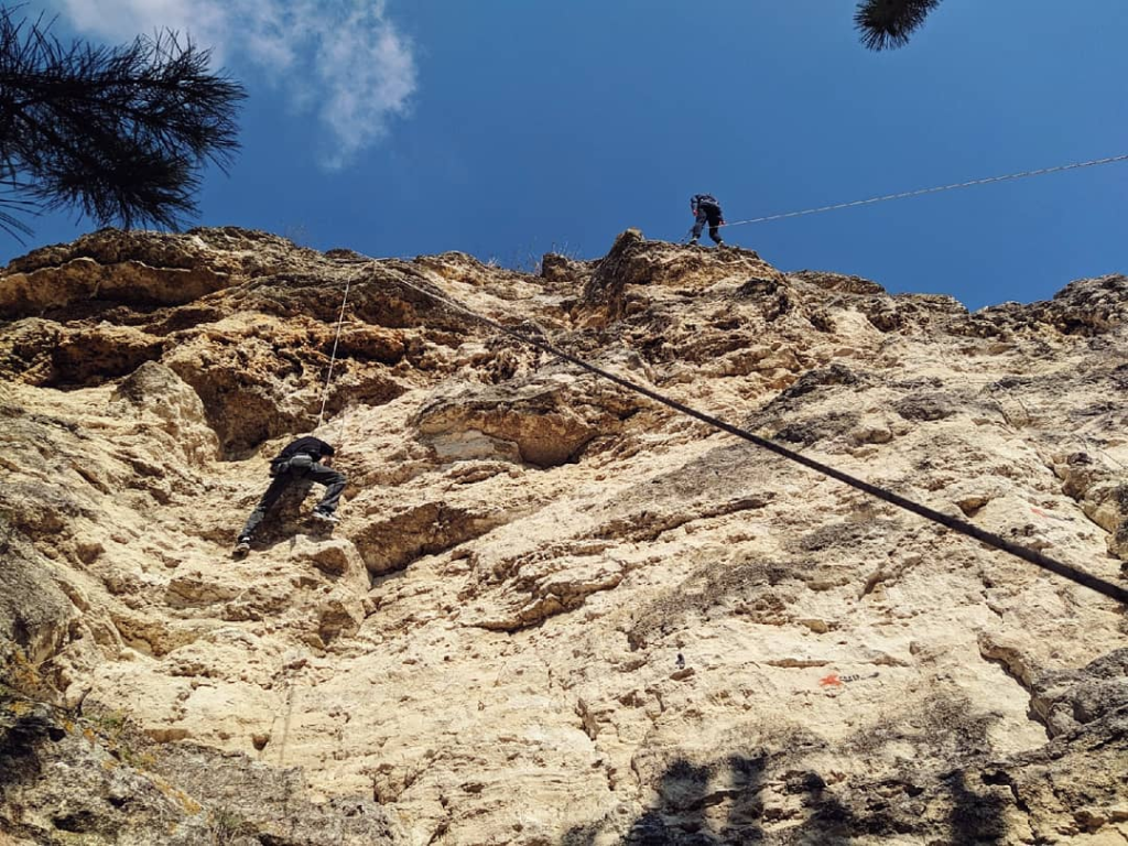
“Svinerest” carries a humorously distinctive name for the rocky summit found in Stroentsy village, though the climbing experience it offers is anything but a joke. The mountain’s structure consists of shell rock formations, making this location one of the finest rock-climbing destinations in all of Pridnestrovie. The steep slope averages approximately 16 meters in height, providing climbers with a substantial vertical challenge.
Dedicated climbing routes have been carefully established on one section of the rock face, with these routes properly cleared to prevent loose rocks and debris from creating hazards for climbers, while safety points have been installed throughout to ensure responsible and secure climbing practice. This combination of natural geological features and thoughtful safety preparation has made Svinerest a popular destination for both experienced climbers and those seeking their first introduction to the sport within the dramatic landscape of the Stroentsy hillside.
Climbing Trail, Kalagur Area
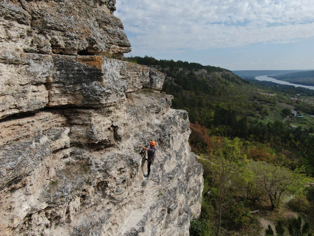
This dedicated climbing trail is situated within the Kalagur area of the Rybnitsa region, not far from Stroentsy village, occupying one of the most genuinely picturesque locations found anywhere throughout Pridnestrovie. Positioned high on a mountain, the trail offers a stunning panoramic view across the Dniester River, rewarding climbers with spectacular scenery alongside their physical challenge.
The rock formations within Stroentsy village have long established themselves as a center of attraction specifically for rock climbing enthusiasts. The mountain’s geological history traces back to when this entire area formed the bottom of an ancient sea, explaining why the structure consists predominantly of shell rock — a composition that creates ideal climbing conditions. This site is widely recognized as the best location in all of Pridnestrovie for rock climbing, with the climbing area reaching an average height of approximately 16 meters, providing sufficient vertical challenge for climbers of varying skill levels while remaining accessible enough for those newer to the sport.
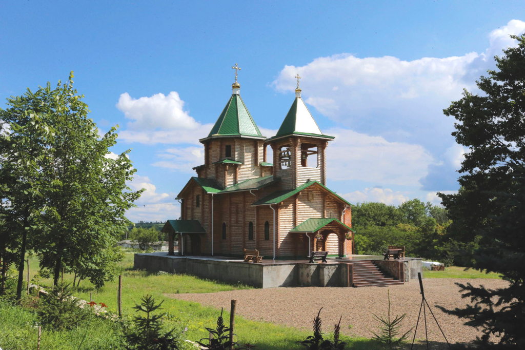
Monastery of John the Precursor, Kalagur Area
On December 31, 2003, the Holy Synod of the Russian Orthodox Church gave its blessing for the opening of a monastery dedicated to St. John the Prophet, Precursor and Baptist, in the Kalagur area of Rybnitsa district. The monastery found its home in the former buildings of the pioneer camp “Era,” nestled near Stroentsy village in one of the most breathtakingly picturesque corners of Pridnestrovie — set deep in the forest, high on a mountain overlooking the Dniester River.
In the summer of 2010, construction began on a Cathedral Church dedicated to the Nativity of John the Baptist, though work on this ambitious project was later halted. The monastery’s architectural story took an unexpected turn in May 2016, when the decision was made to build a wooden church honoring Sophia, the Wisdom of God — a project that would become the only example of wooden church architecture anywhere in Pridnestrovie. Construction began on August 2, 2016, and the completed church now features a beautiful oak iconostasis along with bells in its belfry.
In 2012, with the blessing of Right Reverend Bishop Savva, a chapel was constructed on the monastery grounds specifically to house one of its most revered treasures — the miraculous icon of the Mother of God known as “The Seeking of the Lost,” which continues to draw pilgrims seeking its blessing to this day.
For more information, visitors may contact Archimandrite Zosima (Grzybowski).

Tower of the Winds
Perched dramatically atop a steep rock overlooking Stroentsy, the Tower of the Winds stands as a striking 19th-century architectural monument and one of the most recognizable landmarks in the village. Built in the late 1800s, the tower was raised in memory of Peter Christianovich Wittgenstein — the celebrated Russian military commander and hero of the Patriotic War of 1812, whose legacy shaped the very landscape of this corner of the Dniester valley.
Before the 1917 revolution, the tower’s interior housed a bronze bust of the commander himself, while four cast-iron plates adorned its sides, each inscribed with heartfelt epitaphs honoring Wittgenstein’s memory. One of these moving inscriptions reads:
“Dear father! You have given the foundation for everything here, accept the due recompense for all time.”
Though the bust and some original details have not survived to the present day, the tower itself continues to stand as a powerful symbol of gratitude and remembrance — a tribute carved in stone to a man whose vision and investment transformed Stroentsy into the picturesque village it remains today.

Grape Terraces
The grape terraces of Stroentsy form one of the most significant chapters in the village’s rich history, dating back to the early 19th century when Stroentsy belonged to the estate of Prince Peter Christianovich Wittgenstein. A passionate advocate of viticulture, Wittgenstein cleverly worked with the natural terrain, constructing stone terraces along the eastern slope to create the ideal conditions for cultivating his vines.
On these carefully engineered terraces, he grew both table and technical European grape varieties, even bringing in specialists from Germany to oversee their cultivation and ensure the highest quality. The terraces’ eastern-facing position proved to be a stroke of genius — receiving uninterrupted sunlight from dawn until dusk, this orientation allowed the grapes to ripen beautifully, producing fruit of exceptional quality.
The wines that emerged from these slopes earned a remarkable reputation, regarded as among the finest for preventing and treating gastric ailments — a testament to both the quality of the grapes and the skill of those who tended them. Today, the grape terraces of Stroentsy stand as one of the village’s most treasured historical monuments, a living legacy of Wittgenstein’s vision and the enduring connection between this land and the art of winemaking.
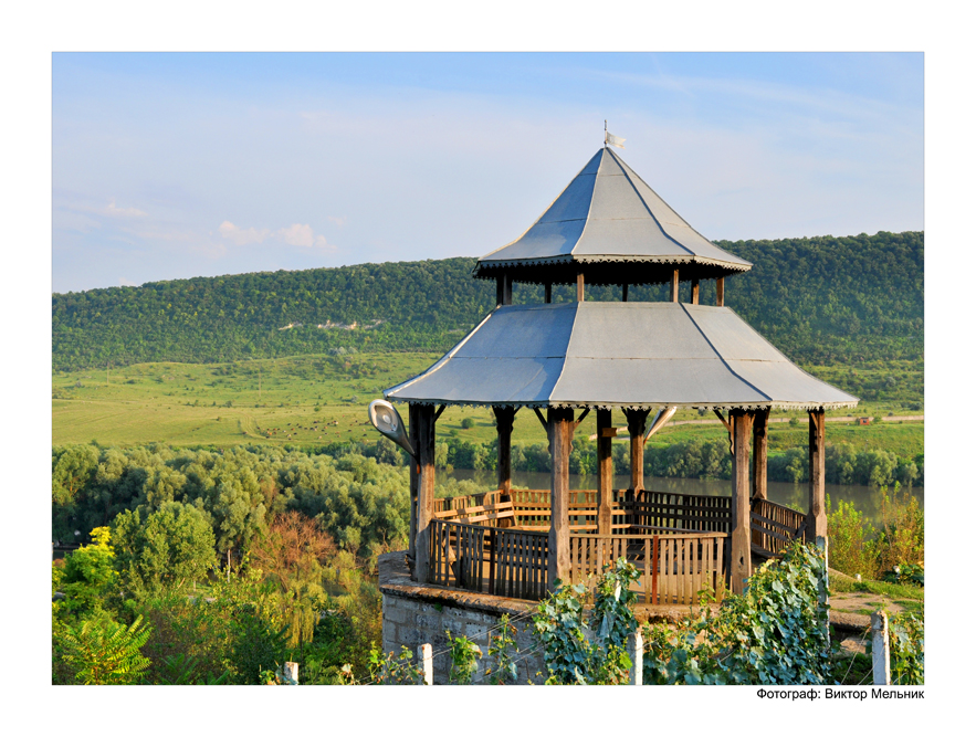
The Countess's Gazebo
Perched on the edge of the slope crowned by the Tower of the Winds, right alongside the famous grape terraces, the Countess’s Gazebo offers one of the most romantic vantage points in all of Stroentsy. This elegant structure was built in 1908 at the order of Maria Petrovna Zinovieva, granddaughter of the legendary Field Marshal Peter Christianovich Wittgenstein — a continuation of her family’s deep connection to this picturesque corner of the Dniester valley.
From the gazebo, visitors are treated to sweeping, scenic views stretching across the Dniester River, the village of Stroentsy below and the rolling countryside beyond. It remains one of the most beloved spots in the village for quiet reflection — a place where the beauty of the landscape and the echoes of aristocratic history come together in perfect harmony.
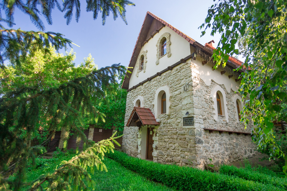
Water Mill
The story of Stroentsy’s iconic water mill begins in 1881, when the construction of the Slobodka–Rybnitsa railway dramatically expanded opportunities for importing machinery from Europe. Seizing on this new connectivity, Transylvanian architect and innovator Georgy Panteleevich Mazgan designed and built a water mill in the village, equipping it with mechanisms imported all the way from Zurich, Switzerland — a remarkable feat of engineering ambition for its time and place.
The mill underwent restoration in 1982, after which the building served for a time as a museum of bread. More recently, this 19th-century structure has been lovingly restored once again, this time at the expense of M.V. Orlov, ensuring its preservation for future generations.
Today, the water mill stands as one of the most beloved attractions not only in Stroentsy but across the entire northern region of Pridnestrovie. The picturesque natural surroundings blend seamlessly with thoughtful landscape design throughout the grounds, creating a setting of genuine charm. Within its historic walls, visitors will now find both a museum dedicated to the mill’s history and the restaurant and hotel complex “Old Mill” — allowing guests to dine, stay and explore all within this remarkable piece of living heritage.
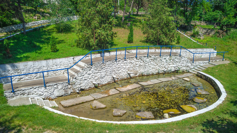
"Teplitsa" Springs System
The “Teplitsa” springs system ranks among the most renowned natural water sources in the entire district, prized for the purity and freshness of its flow. A cherished local tradition has taken root around these springs over the years: every January 19th, on the Orthodox feast of Epiphany, the waters here are ceremonially consecrated — drawing locals and visitors alike to witness and take part in this meaningful religious observance.
Beyond its spiritual significance, the springs continue to serve as a beloved natural landmark in Stroentsy, offering refreshing, crystal-clear water that has drawn villagers and travelers to this spot for generations.
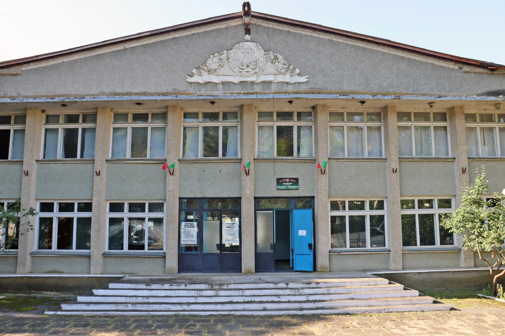
Museum of P.A. Rumyantsev-Zadunaisky and the History of Stroentsy Village
Stroentsy village holds the distinction of being the birthplace of the great Russian commander Peter Alexandrovich Rumyantsev. His mother, Countess M.A. Rumyantseva, resided in this village for approximately six months while awaiting the return of her husband, who had traveled to Turkey on assignment for Peter the Great. It was here that she gave birth to her son, Peter Alexandrovich, on January 15, 1725 — connecting this small Dniester village directly to one of Russian military history’s most celebrated commanders.
A significant portion of the museum’s exposition focuses specifically on Rumyantsev’s remarkable life path. Visitors can explore photographs and photocopies of documents detailing P.A. Rumyantsev’s extensive military activities, alongside a bust honoring this distinguished field marshal. Another substantial section of the museum’s materials addresses Field Marshal P.Kh. Wittgenstein, whose estate encompassed Stroentsy village throughout the 19th century, connecting two significant military figures to this single remarkable location.
On a picturesque rocky ledge within the village stands the famous “Tower of the Winds” — a monument to Wittgenstein erected by his own daughter, representing one of the most architecturally distinctive tributes found anywhere in this region. Within the museum itself, housed in the building of the rural House of Culture, visitors can learn comprehensively about the founding and development of Stroentsy village while viewing old household items and traditional tools that bring the daily life of past generations vividly to life.

Church of St. Michael the Archangel, Stroentsy Village
The story of the Church of St. Michael the Archangel in Stroentsy begins with the original wooden church, first established in 1702. This early structure was destroyed in the 1820s, and the land was subsequently used to build a palace for Prince Trubetskoy, which itself eventually collapsed in 1918, marking another chapter in this site’s layered architectural history.
Construction of the present church began in 1829, funded by Peter Christianovich Wittgenstein, whose patronage shaped so much of Stroentsy’s development during this period. A particularly distinctive feature of this temple lies in its architecture, which thoughtfully blends Orthodox and Lutheran traditions — the stone bell tower, topped with a distinctive spoke-shaped peak, bears a clear resemblance to German church design, creating a fascinating cross-cultural architectural statement that reflects the diverse influences present in this corner of the Dniester valley.
The church’s role in the community extended beyond purely religious functions: a school was established on its grounds in 1861, embedding the temple within the educational life of the village as well as its spiritual life. In the 20th century, to mark the 40th anniversary of Victory over Nazi Germany in the Great Patriotic War, a military history museum was opened here, named after P.A. Rumyantsev-Zadunaisky, adding yet another dimension to this multifaceted site. Finally, in the 1990s, the church underwent restoration and resumed functioning according to its original sacred purpose, completing a journey that saw this remarkable building serve religious, residential, educational and museum functions across more than three centuries.